


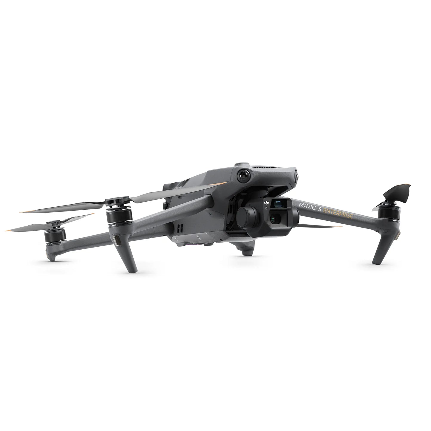
DJI Mavic 3 Enterprise
DJI Mavic 3 Enterprise

Couldn't load pickup availability


- Description
- Specifications
- In the Box
- FAQ
DJI Mavic 3 Enterprise sets new standards for small commercial drones
When it comes to small commercial drones, the DJI Mavic 3 Enterprise Series is setting new standards. One of the variants in this series is DJI Mavic 3E.
Like all the other variants, this bundle takes mapping and mission efficiency to a whole new level with a mechanical shutter, a 56x zoom camera, and an RTK module option for centimeter-level accuracy.

The drone in the package is designed to perform on extended missions, making it ideal for both novice and experienced pilots. For nighttime operations, search and rescue, inspection, and combating fires, a thermal variant is provided.
Portability and operational efficiency
Weighing just about 915 g, Mavic 3 Enterprise is one of the market's lightest and most compact enterprise drones. It can be quickly deployed and can be easily held in one hand.
The batteries of the aircraft are optimized for endurance. With a 45-minute flight time at full charge, you may survey up to 2 square kilometers in a single trip, increasing the amount of ground you can cover on every mission.
After the flight, you may directly charge the drone with 88W or use a 100W charging hub to charge the batteries quickly.
Better mapping and surveying capabilities
Without the need for Ground Control Points, the DJI Mavic 3E's exceptional feature set allows for improved mapping and surveying efficiency.
With the Intelligent Low-Light Mode and a 20 MP wide-angle camera integrated into a 4/3 CMOS sensor with huge 3.3 mm pixels, you get a camera that performs well even in low light.
The drone also features a strong hybrid zoom lens of up to 56x. Even better, you can capture photographs with a 12MP equivalent focal length of 162mm. Motion blur is eliminated via a mechanical shutter, which also enables quick 0.7-second interval shooting.
Optimal image transmission
The DJI Mavic 3 Enterprise drone can fly farther and transmit signals with more stability thanks to DJI O3 Enterprise Transmission, which allows for a maximum control range of 15 km. This gives pilots more confidence when flying.
The aircraft also offers a 1080p/30fps high frame rate live broadcast. Transmission distance is a proxy for signal strength.
Flight safety a priority
DJI has always been at the forefront of the drone market in terms of creating cutting-edge safety features, and the DJI Mavic 3E carries on this tradition with better object detecting and navigation algorithms that provide drone pilots with the direction they need to remain safe.
The M3E drone has DJI AirSense, which collects ADS-B signals from surrounding conventional aircraft to alert drone pilots of nearby air activity.
Six omnidirectional fish-eye sensors are also installed, enabling the new and upgraded DJI APAS system 5.0 for obstacle detection with no blind spots.
Features that optimize operations
- Mechanical Shutter: This type of shutter in Mavic 3E mechanically eliminates motion blur, thus creating crisp clear images of moving objects as well. This is highly useful for mapping and surveying applications.
- 20 MP Wide Camera: The wide-angle camera's 4/3 CMOS sensor comprises 20 MP cameras, thus providing a much higher resolution for imaging needs; great for detailed inspections and accurate maps.
- Precision RTK Module: You can attach an RTK module (sold separately) that provides centimeter accuracy level, suitable for any kind of surveying and mapping applications that depend on obtaining precise geospatial data.
- Extended Flight Time: Mavic 3E will allow extended mission time for 45 minutes. This extends large areas accurately covered without having to swap the battery too frequently.
- All-around Obstacle Sensing: Sensors are installed all around the Mavic 3E, which increases safety through collision avoidance in complex environments.
Use cases for the DJI Mavic 3 Enterprise
- Mapping and Surveying: Mavic 3E is the perfect drone for high accuracy capture of data for topographic surveys, construction site mapping, and land assessments. RTK functionality will offer the reliability and accuracy of the data captured.
- Infrastructure Inspections: Mavic 3E is used to inspect bridges, power lines, among many others; thus, offering higher resolution images to see potential issues before they become more costly problems.
- Crop Monitoring: Equipped with advanced cameras the Mavic 3E will allow farmers to monitor crop health, track irrigation needs, and disease/pest infestations early in development stages.
- Public Safety: The Mavic 3E can be provisioned to law enforcement and emergency services for responding to search and rescue, accident reconstruction, and crowd monitoring activities with high-resolution images and long endurance flights.
You may contact our drone experts at (877) 299-1075 if you are looking for a customized M3E bundle suitable for your organization’s needs or if you need help jump-starting your organization’s drone program.

