


ACSL SOTEN Agriculture Package
ACSL SOTEN Agriculture Package

Couldn't load pickup availability


- Description
- Specifications
- In the Box
- FAQ
ACSL SOTEN Agriculture Package - Field Intelligence in One Secure Package
The ACSL SOTEN Agriculture Package delivers a complete drone platform for modern precision farming.
With the NDAA-compliant SOTEN drone, the advanced Multispectral Camera, and the rugged TAITEN Smart Controller, this system provides the data, visibility, and control needed for high-performance crop management.
Agriculture Bundle Highlights
Smart control, secure data, and field-proven performance come standard in this bundle.
- ACSL SOTEN Multispectral Camera for NDVI and vegetative health analysis
- Captures critical ag bands (550nm, 680nm, 850nm) for crop assessment
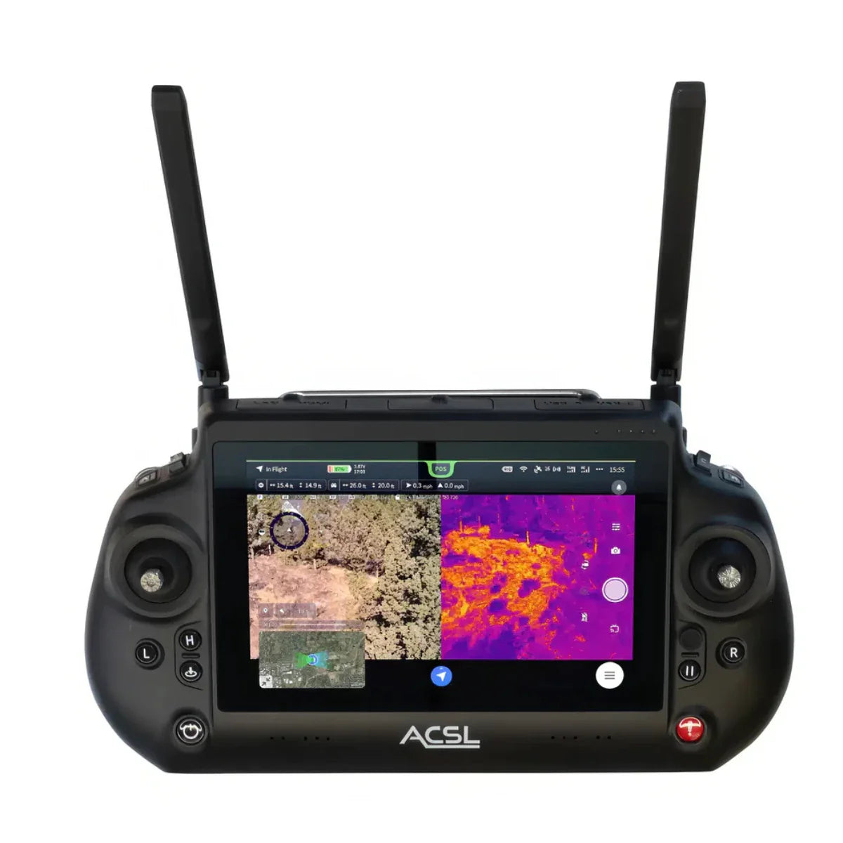
- TAITEN Smart Controller: 7″ daylight display with 1200×1920 resolution
- AES256 encryption ensures secure drone-to-controller communication
- Reduced video latency and customizable flight settings
- LTE-enabled BVLOS operation with a 2.5-mile range
- Swappable camera bay supports sensor upgrades mid-operation
- NDAA and ISO15408-compliant drone system
- FAA Remote ID compliant
- 1.7 kg foldable drone with 25-minute flight time
Designed for Real-World Field Conditions
Capture multispectral data (550nm, 680nm, 850nm) to assess crop health, plan inputs, and detect anomalies-all with the SOTEN Multispectral Camera.
Operate confidently in direct sunlight, rain, or dust with the IP43-rated TAITEN Smart Controller. Its integrated 7″ display provides 1200 × 1920 resolution at 1500 nits, remaining fully visible in direct sunlight.
The upgraded compute platform shortens feedback loops for gimbal, flight, and payload inputs, ensuring responsive operation during time-critical missions. Customizable switches, wheels, and buttons allow operators to tailor controls for precise handling.
Applications
From specialty crops to large-acre farms, this platform adapts to key use cases:
- NDVI mapping and crop stress analysis
- Precision irrigation and resource use planning
- Early detection of disease, pests, or nutrient issues
- Canopy density and yield estimation
- Environmental monitoring and compliance
- Livestock perimeter checks and pasture tracking
Dronefly partners with agricultural professionals who need drone systems that do more than fly-they need actionable insight. That's why we help configure, deploy, and support your ACSL SOTEN Agriculture Package from start to scale.
We specialize in enabling efficient drone-based workflows-from activating LTE and Remote ID to guiding NDVI and multispectral data collection. When your season, yield, or compliance depends on the data, Dronefly ensures you get it reliably.
Order the ACSL SOTEN Agriculture Package from Dronefly and experience precision farming with secure, advanced tools.

