


Autel EVO II Dual 640T & 6K Rugged Bundle V1 Combo (Used)
Autel EVO II Dual 640T & 6K Rugged Bundle V1 Combo (Used)

Couldn't load pickup availability

- Description
- Specifications
- In the Box
- FAQ
Autel EVO II Dual 640T V1 & EVO II Pro 6K V1 Rugged Bundle (Used): Complete Dual-Drone Thermal and 6K Imaging Solution
Professionally tested and verified in like-new condition, this Dronefly dual-aircraft bundle unites the Autel EVO II Dual 640T V1’s FLIR thermal precision with the EVO II Pro 6K V1’s ultra-high-definition imaging. Purpose-built for enterprise missions, it gives teams instant access to thermal diagnostics and optical documentation in a single, rugged case.
Thermal and visual coverage in one field kit
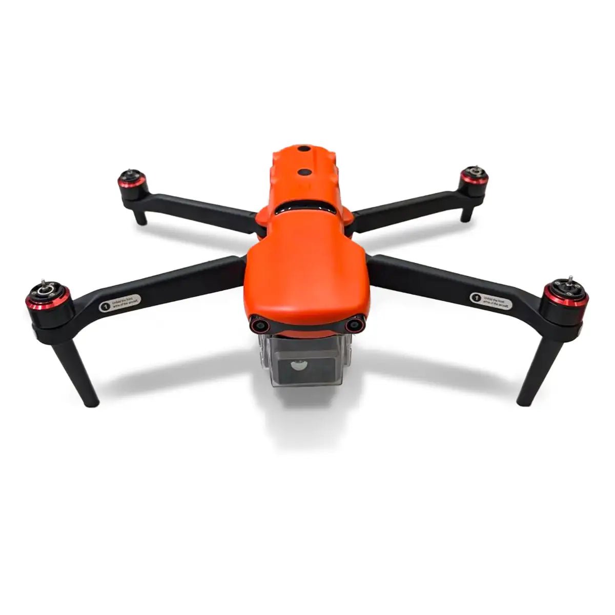
The Dual 640T V1 captures 640×512 radiometric thermal data with temperature measurement capabilities up to 150 °C, while the Pro 6K V1 records 6K video and 20 MP stills from its 1-inch CMOS sensor. Both drones deliver up to 40 minutes of flight and 9 km control range with 360° obstacle avoidance, ensuring safe and efficient operation for industrial, public-safety, and aerial-survey tasks.
Rugged reliability and enterprise readiness
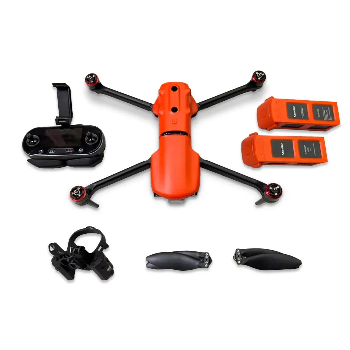
Packed inside a GPC Rugged Case, this dual-drone system includes two controllers, five batteries, and mission accessories. Each Autel V1 aircraft is verified for firmware stability and sensor accuracy. Dronefly ensures these units meet enterprise standards for thermal and visual performance across inspection, emergency response, and survey applications.
Core Features and Advantages
- Dual-aircraft system: EVO II Dual 640T V1 and EVO II Pro 6K V1
- Thermal sensor: FLIR Boson 640×512 radiometric core
- 6K camera: 1-inch CMOS with adjustable f/2.8–f/11 aperture
- Flight duration: up to 40 minutes per drone
- Control range: 9 km maximum (FCC)
- Obstacle avoidance: 12-direction sensing with 360° coverage
- GPC Rugged Case: dual-drone foam layout for transport protection
- Included gear: two controllers, five batteries, props, charger
- Software control: Autel Explorer App for flight and thermal view
- Certified like-new by Dronefly technicians
Hardware and Software Compatibility
- Control software: Autel Explorer (iOS/Android)
- Data tool: Autel Thermal Analysis Tool (PC)
- GNSS: GPS + GLONASS for precise flight tracking
- Storage: microSD up to 256 GB supported
- Firmware: latest Autel EVO II V1 updates applied
- Output formats: JPG, DNG, MP4, MOV
- Integration: compatible with GIS and thermal post-processing systems
Operational Scenarios
- Search and rescue: detect subjects through infrared signatures
- Fire management: monitor and analyze thermal hotspots
- Infrastructure inspection: identify heat irregularities or structural faults
- Law enforcement: support surveillance and scene analysis
- Industrial utilities: inspect power lines and solar arrays
- Environmental work: observe wildlife or terrain conditions
- Mapping projects: capture accurate 6K aerial data sets
- Media production: produce high-fidelity visuals with manual control
- Disaster response: rapid thermal assessment of incident zones
- Public safety: deploy for situational awareness and documentation
Engineered for Enterprise Performance
Dronefly delivers a dual-drone solution that combines thermal and visual imaging in a single, deployable package. The EVO II Dual 640T V1 and EVO II Pro 6K V1 provide redundancy, mission continuity, and data accuracy—ideal for operators demanding reliable V1 hardware with like-new performance.

