


DJI Zenmuse L3 with Dronefly Care Plus
DJI Zenmuse L3 with Dronefly Care Plus

Couldn't load pickup availability


- Description
- Specifications
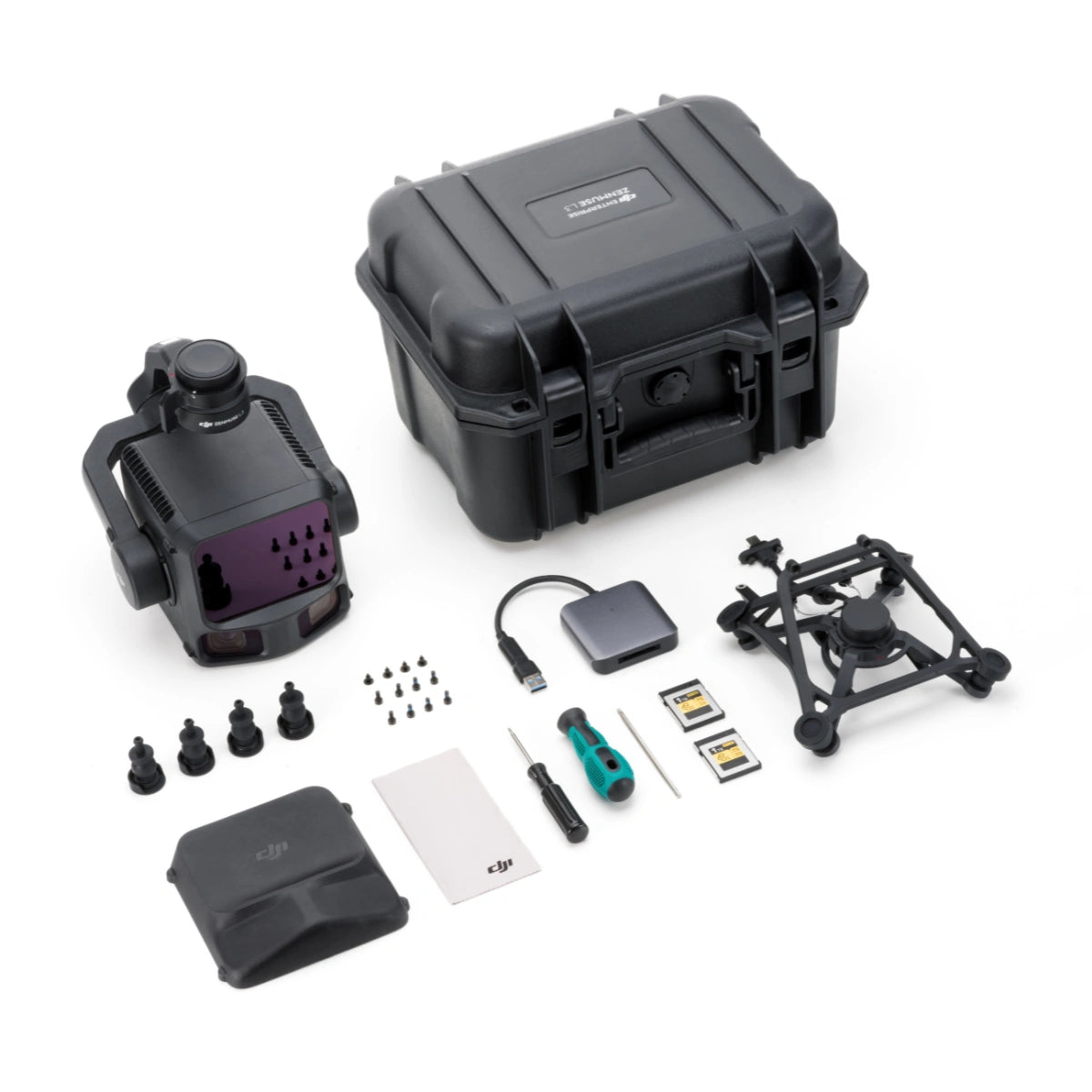
- In the Box
- FAQ
DJI Zenmuse L3 with Dronefly Care Plus: professional LiDAR scanning and detailed RGB mapping
The DJI Zenmuse L3 is a long-range LiDAR and dual 100 MP RGB mapping payload designed for teams that require accurate 3D data collection across challenging landscapes. Built for the Matrice 400 Series, the system integrates LiDAR, dual high-resolution cameras, and a synchronized POS module to streamline aerial surveying and inspection tasks.
This package includes complete mounting and storage equipment along with Dronefly Care Plus, providing 13 months of accidental-damage protection for enterprise missions requiring dependable uptime.
Key features and technical benefits
- Long-range LiDAR provides dependable scanning performance across large terrain areas.
- Dual 100 MP cameras capture wide-area RGB data with detailed clarity.
- Shutter flexibility supports distortion control in dynamic flight environments.
- Integrated POS enhances accuracy for survey-grade mapping workflows.
- Broad horizontal field of view increases overall coverage efficiency.
- Scan modes support flexible LiDAR capture across varied mission types.
- IP54 resistance ensures durability in rugged field conditions.
- CFexpress Type B storage handles large sensor outputs effectively.
- Short capture intervals improve productivity across extensive survey missions.
- DJI ecosystem integration supports efficient planning and processing pipelines.
Advanced sensing performance for high-quality terrain and structural mapping
The L3’s 1535 nm LiDAR achieves detection up to 950 meters at low reflectivity and up to 2000 meters under favorable conditions, enabling efficient surveying across diverse sites. Its dual 100 MP 4/3 CMOS imaging system widens the capture footprint to a combined 107-degree horizontal field of view, reducing required flight lines during mapping operations.
With mechanical and electronic shutter options, rapid photo intervals, CFexpress Type B storage, multiple scan patterns, and pulse rates ranging from 240–480 kHz depending on DJI’s mode specifications, the L3 supports demanding geospatial and engineering workflows.
Precision reliability and operational resilience with extended protection
Accurate 3D outputs are supported by the integrated POS module, which achieves centimeter-level positioning when paired with RTK correction. Environmental durability is reinforced through IP54 protection and a broad operating temperature range.
Dronefly Care Plus adds structured protection for 13 months, covering accidental damage from collisions, drops, water exposure, signal interference, and internal issues with one replacement available. This helps maintain operational continuity for organizations with time-sensitive missions.
Platform connectivity and operational ecosystem
- Built for Matrice 400 Series, installed using the included single-port gimbal mount.
- Supports DAT, RINEX, RTCM, and OEM GNSS formats for RTK and PPK workflows.
- Managed through DJI Pilot 2 for flight control and capture oversight.
- Data processed with DJI Terra for LiDAR and RGB reconstruction.
- DJI Modify refines mapped datasets through point cloud editing.
- DJI FlightHub 2 offers cloud-based operations and mission coordination.
- CFexpress Type B media provides consistent high-throughput data handling.
- Final outputs compatible with common GIS and engineering software environments.
Industry applications and mission scenarios
- Survey mapping: detailed topography captured from high-density point clouds.
- Utility inspection: 3D modeling for overhead lines, substations, and structures.
- Construction workflows: site documentation and progress updates for AEC teams.
- Forestry analysis: canopy structure and terrain insights from LiDAR penetration.
- Mining operations: volumetric assessments and terrain monitoring tasks.
- Municipal planning: land-use assessments and infrastructure planning support.
- Emergency operations: rapid scene modeling for post-incident documentation.
- Linear corridor mapping: efficient surveys of railways, pipelines, and powerlines.
- Infrastructure modeling: accurate datasets for maintenance planning.
- Environmental studies: elevation and terrain data for hydrology and erosion work.
Engineered for enterprise use and streamlined workflows
The Zenmuse L3 integrates LiDAR, imaging, and positional alignment systems to support complex aerial data acquisition with minimal payload complexity. Its environmental resilience and high data throughput make it suitable for routine enterprise deployment.
Dronefly Care Plus further strengthens operational reliability, offering accident protection that reduces downtime and supports mission-critical operations throughout the coverage period.
The Zenmuse L3 with Dronefly Care Plus delivers accurate LiDAR scanning, wide-area RGB mapping, and extended operational protection for enterprise users who rely on consistent aerial data. Order from Dronefly today — the West Coast’s trusted enterprise UAV source.

