


DJI Zenmuse P1
DJI Zenmuse P1

Couldn't load pickup availability


- Description
- Specifications
- In the Box
- FAQ
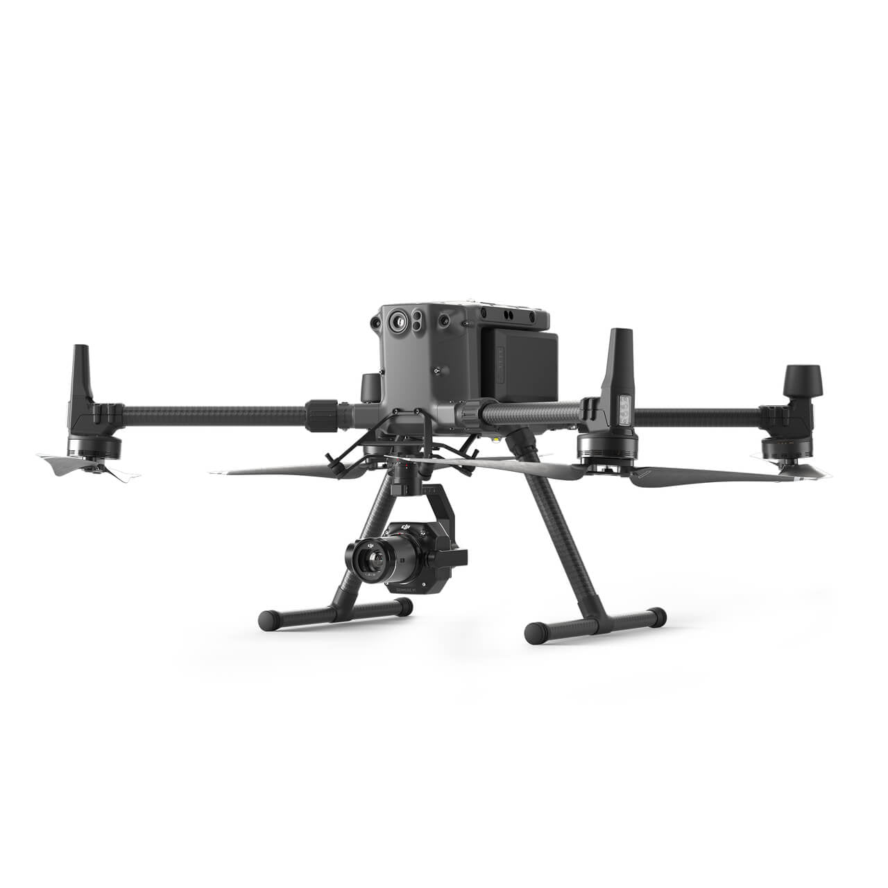
DJI Zenmuse P1 Camera for Aerial Surveying
The Zenmuse P1 integrates a full-frame sensor with interchangeable fixed-focus lenses on a 3-axis stabilized gimbal.

Designed for photogrammetry flight missions, it takes efficiency and accuracy to a whole new level.
- Accuracy without GCPs: 3 cm horizontally / 5 cm vertically
- High Efficiency: 3 km² covered in a single flight
- 45 MP Full-frame Sensor
- 3-axis Stabilized Gimbal, Smart Oblique Capture
- Global Mechanical Shutter Speed 1/2000 Seconds
- TimeSync 2.0 - synchronization at the microsecond level

Your Go-to Tool for Aerial Photogrammetry
Extraordinary Efficiency
- The P1 includes a full-frame, low-noise high-sensitivity sensor that can take a photo every 0.7 s during the flight, and covering 3 km² in a single flight.
Remarkable Accuracy
- Equipped with a global mechanical shutter and the all-new TimeSync 2.0 system, which synchronizes time across modules at the microsecond level, the Zenmuse P1 lets users capture centimeter-accurate data combined with the real-time position and orientation compensation technology.
Robust Versatility
- Create 2D, 3D, and detailed models thanks to the integrated 3-axis gimbal that can be outfitted with 24/35/50mm lenses and the Smart Oblique Capture feature.
Efficiency to Cover It All - Full-frame Camera
- 45MP Full-frame Sensor
- 4.4µm Pixel Size
- Low-noise, high sensitivity imaging extends daily operational time
- Take a photo every 0.7 s during the flight
- TimeSync 2.0 aligns the camera, flight controller, RTK module, and gimbal at the microsecond level
Flexibility to Capture It All - Multiple Fixed-focus Lens Options
- Global Mechanical Shutter, Shutter Speed 1/2000 Seconds
- Sends the median exposure pulse in microseconds
- Supports 24/35/50mm lenses with DJI DL mounts

Work Smart, Work Fast
Smart Oblique Capture
- Cover 7.5 km² in a single workday with the P1. Elevate the efficiency of your oblique photography mission using Smart Oblique Capture, where the gimbal automatically rotates to take photos at the different angles needed.
- Only photos essential to the reconstruction will be taken at the edge of the flight area, increasing the efficiency of post processing by 20% to 50%.

Smart Data Management
Your mission data management – streamlined.
- Mission result files are automatically associated with the Mission Name and Mission Time.
- Centralized storage location for photos, GNSS data, and TimeStamps.MRK files.
- Image metadata contains the camera’s intrinsic and extrinsic parameters and the status of RTK.
Fieldwork Report
Verify data quality immediately post-flight by checking the position data and number of the images acquired, as well as RTK status and positioning accuracy.
A Mission Mode for Every Scenario
2D Orthomosaic Mission
Generate orthomosaics without GCPs using the P1, perfect for medium to large-area operations.
3D Oblique Mission
Effortlessly acquire oblique images from multiple angles that meet 3D modeling requirements across industries such as urban planning and centimeter-level accurate cadastral surveys to serve 3D reality models and smart city planning.
Detailed Modeling Mission
Acquire ultra-high resolution image data of vertical or slanted surfaces from a safe distance that faithfully recreates fine textures, structures, and features, for detailed reconstructions, geological surveys, heritage site conservation, hydraulic engineering, and more.
Real-time Mapping Mission
Gather geographic information of large areas in real-time using DJI Terra so that teams can make crucial decisions quickly on site.
Precision in Action: Where the Zenmuse P1 Excels
- Surveying and Mapping: This high-resolution Zenmuse P1 will be suitable for surveying and mapping large areas, mainly for provision of details in construction or urban planning and land management. With its high-resolution imagery and intelligent data management, the process of assembling precise maps and 3D models will be greatly simplified.
- Infrastructure Inspection: The P1, coupled with its ultra-high definition image capture and mechanical shutter, is pretty much suited for critical infrastructure inspection on roads, bridges, and power lines. Highly detailed imagery taken helps identify potential issues before they reach a boiling point, thus preventing critical infrastructure from becoming hazardous or inoperable.
- 3D Modeling: The P1 device has such strong imaging capacities that it leaves many applications totally covered. Whether the application will be preservation of archaeological sites or digital reconstruction, the P1 provides the detailed imagery needed to create highly accurate models of sites.
-
Environmental Monitoring: The Zenmuse P1 is also useful in environmental monitoring, where professionals can survey vast landscapes and track the changes in ecosystems over time. Its precise data capture helps assess land degradation, deforestation, and wildlife habitats.
The DJI Zenmuse P1 provides efficient, accurate aerial mapping for professional survey operations. It is designed for organizations that rely on high-quality geospatial data.
Order from Dronefly today, the West Coast’s trusted enterprise UAV source.

