


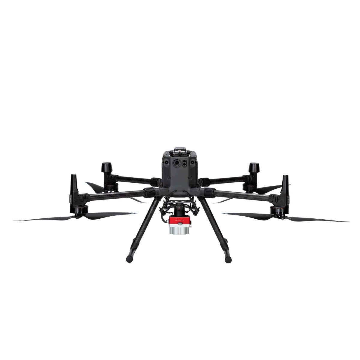
MicaSense Altum-PT with DJI M300/M350 SkyPort Kit
MicaSense Altum-PT with DJI M300/M350 SkyPort Kit

Couldn't load pickup availability


- Description
- Specifications
- In the Box
- FAQ
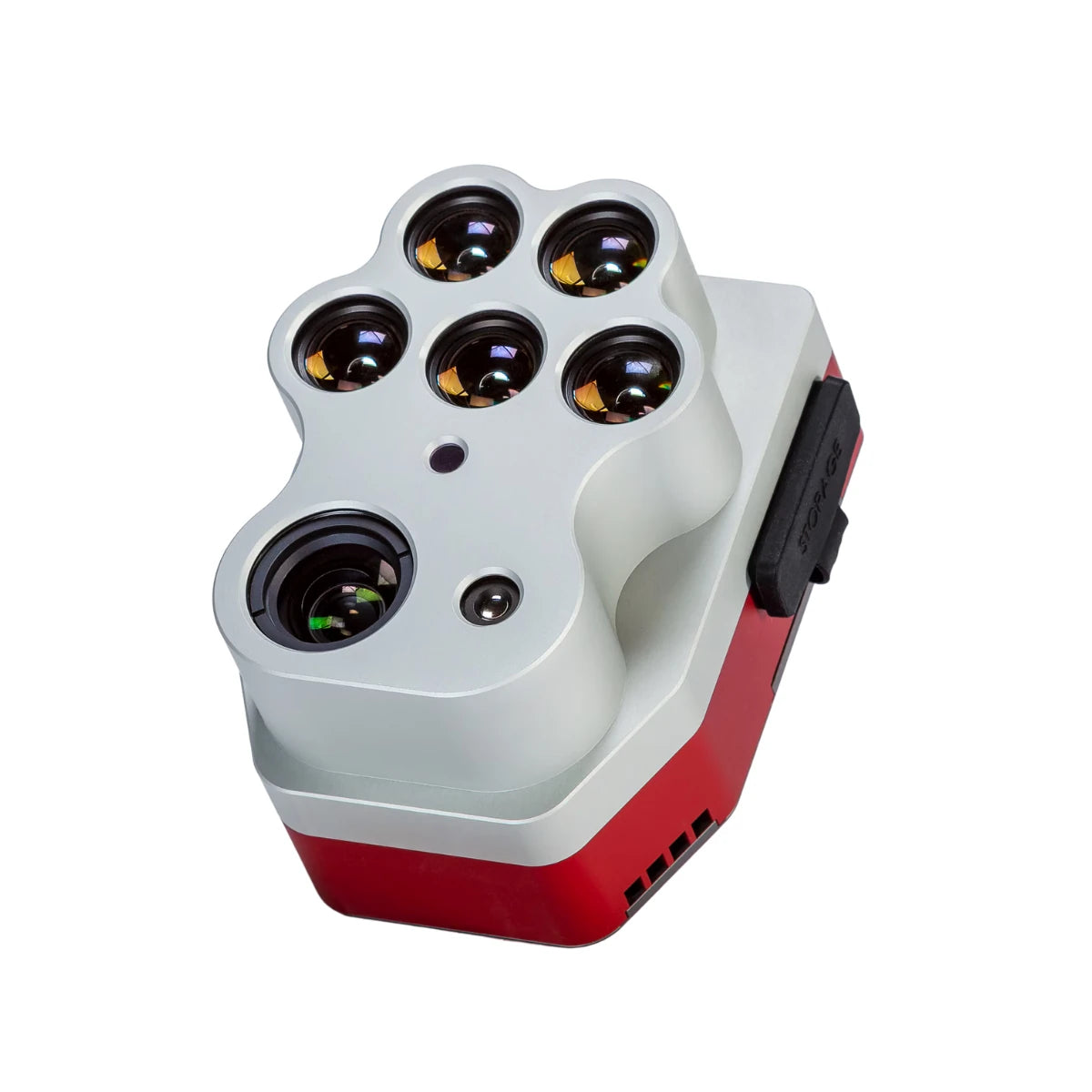
MicaSense Altum-PT with SkyPort Kit: Pixel-aligned multispectral and thermal data with SkyPort integration
The MicaSense Altum-PT with SkyPort Kit is an enterprise-ready imaging bundle that pairs advanced multispectral and thermal sensing with direct DJI SkyPort integration. It combines the Altum-PT sensor with the SkyPort adapter designed specifically for secure mounting on supported DJI enterprise aircraft. This bundle enables synchronized capture of multispectral, panchromatic, and thermal imagery in a single flight, delivering pixel-aligned datasets for professional agriculture, research, and environmental monitoring missions.
Integrated sensing and synchronized data capture
- Multispectral resolution: 2064 × 1544 pixels per band
- Panchromatic resolution: 4112 × 3008 pixels, 12 MP
- Thermal resolution: 320 × 256 radiometric thermal imaging
- FLIR LWIR thermal sensor: 7.5–13.5 µm spectral range
- Synchronized capture across all sensors
- Pixel-aligned spectral and thermal outputs
- Integrated DLS 2 included with Altum-PT
- CFexpress storage supports high-volume missions
Spatial precision for advanced analytical workflows
Altum-PT delivers spatial detail suited for precision analytics and research-grade workflows. The high-resolution panchromatic sensor supports pan-sharpened outputs down to 1.25 cm per pixel at 60 m and 2.49 cm per pixel at 120 m. Multispectral and thermal imagery remain aligned to this spatial detail, enabling confident interpretation of vegetation indices and temperature patterns. Capturing all data modalities simultaneously improves consistency and reduces uncertainty during processing.
Thermal data as a core analytical layer
Thermal imaging is fully integrated into the Altum-PT sensing workflow. The FLIR LWIR radiometric thermal sensor captures temperature data at 320 × 256 resolution across the 7.5–13.5 µm range. This supports irrigation analysis, soil moisture evaluation, and crop stress assessment. When combined with synchronized multispectral imagery, thermal data provides deeper insight into plant health and water performance across professional operations.
Supported aircraft and SkyPort mounting
- DJI Matrice 300 RTK: Supported via included SkyPort Kit
- DJI Matrice 350 RTK: Supported via included SkyPort Kit
- DJI Matrice 400: Not yet supported
- Direct SkyPort interface: Secure mechanical and electrical connection
- Stable mounting: Maintains proper sensor alignment during flight
- Reduced setup time on supported aircraft
Operational use cases for the bundle
- Precision agriculture mapping and analytics
- Irrigation system evaluation and water stress monitoring
- Crop health assessment using thermal and multispectral data
- Environmental and vegetation research surveys
- High-resolution multispectral and thermal mapping
- Time-series monitoring programs
- Enterprise UAV analytics workflows
- Professional data collection missions
Compare: Altum-PT vs RedEdge-P
| Category | Altum-PT | RedEdge-P |
|---|---|---|
| Core focus | Multispectral + thermal + RGB in a single payload | High-resolution multispectral + RGB capture |
| Thermal capability | Radiometric FLIR LWIR, 320 × 256 | Not available (no thermal sensor) |
| Multispectral bands | 5 bands: Blue, Green, Red, Red Edge, NIR | 5 bands per sensor; up to 10 bands with a dual-camera configuration |
| RGB / panchromatic | 12 MP panchromatic sensor | 5.1 MP panchromatic output (pan-sharpened) |
| Multispectral GSD @120 m | 5.28 cm/pixel | 7.7 cm/pixel |
| Pan-sharpened spatial detail | 2.49 cm/pixel @120 m (≈1.25 cm/pixel @60 m) | ≈3.98 cm/pixel @120 m (≈2 cm with pan-sharpening) |
| Thermal GSD @120 m | 33.5 cm/pixel | N/A |
| Capture rate | Up to 2 images per second (all bands, RAW) | Up to 3 images per second (RAW) |
| Media / storage | CFexpress card | CFexpress card |
| Radiometric calibration | Integrated multispectral + thermal calibration | Multispectral calibration with dual calibration panels |
| Typical system weight | ≈577 g | ≈745 g (dual-sensor configuration) |
| Where it fits best | Irrigation diagnostics, water stress, soil moisture, thermal crop analysis | Vegetation indices, crop vigor, classification, time-series analysis |
Built for enterprise UAV programs
This bundle is designed for professional UAV fleets that require consistent integration and dependable data quality. The included SkyPort Kit ensures secure mounting on supported DJI platforms, while integrated light sensing supports radiometric reliability under variable illumination. Together, the components form a cohesive system suitable for long-term monitoring and operational decision-making.
Altum-PT with SkyPort Kit provides a complete sensing and mounting solution for teams that need accurate, repeatable, and actionable aerial data.
Order from Dronefly today — the West Coast’s trusted enterprise UAV source for advanced sensing payloads and professional integration support.

