


Terra Xross 1 Indoor Inspection Drone
Terra Xross 1 Indoor Inspection Drone

Couldn't load pickup availability


- Description
- Specifications
- In the Box
- FAQ
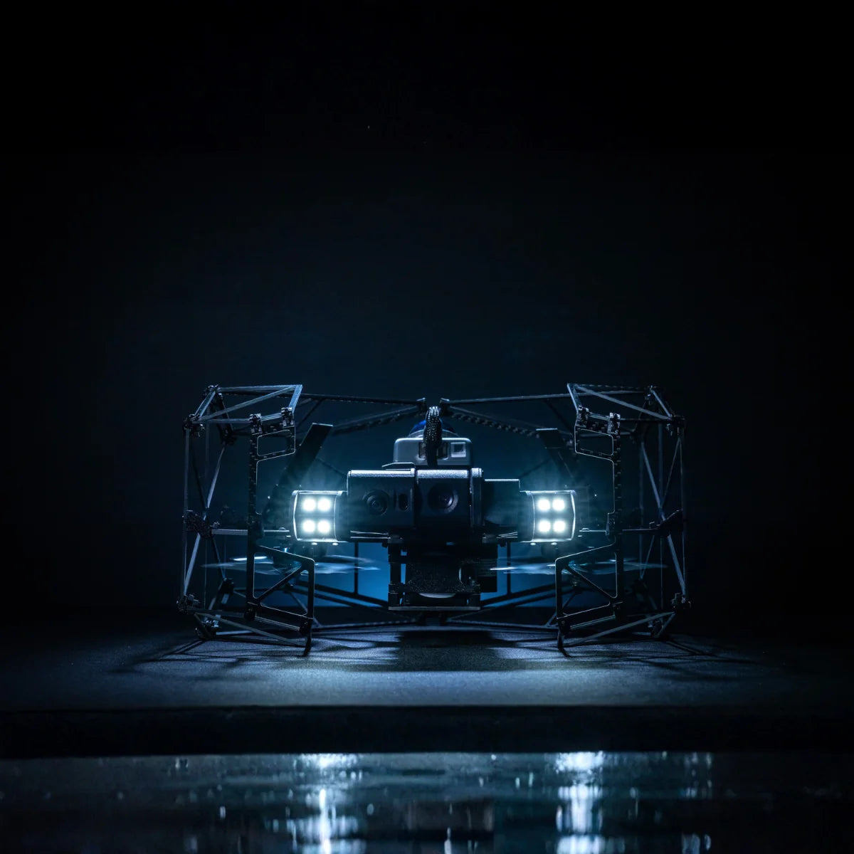
Terra Xross 1: Japan-Made GNSS-Free Indoor Inspection Drone With LiDAR Stabilization and 4K 180° Tilt Camera
The Terra Xross 1 is a purpose-built indoor inspection drone developed and manufactured in Japan by Terra Drone Corporation for the confined spaces, dark interiors, and dusty industrial environments where outdoor platforms cannot operate and where sending workers in carries real risk.
Without any reliance on GPS, it maintains stable hover and controlled flight through a combination of LiDAR and visual odometry sensors that estimate position based on physical displacement rather than visual references — keeping the aircraft steady in conditions that defeat camera-only stabilization systems.
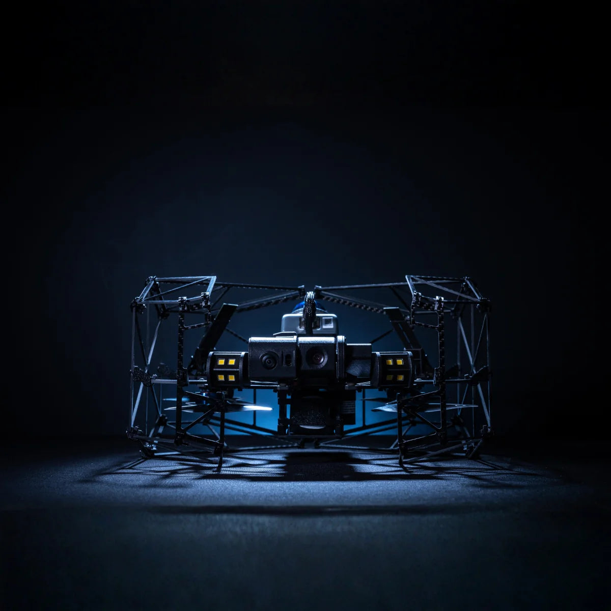
A 4K camera with 180° vertical tilt and integrated LED illumination captures clear inspection footage at any angle, and real-time 3D LiDAR data streams to the operator's display for safe BVLOS navigation around obstacles throughout the mission. Developed specifically to broaden access to indoor drone inspection capability, it is designed to be within reach of operators and programs that existing indoor platforms have priced out.\
Key Features and Benefits
- GNSS-free stabilization: LiDAR and visual odometry sensors maintain position in dark, dusty, cramped spaces.
- 4K 180° tilt camera: captures high-resolution footage at any angle with integrated LED illumination.
- Class 1 LiDAR: 200,000 points per second at 10 Hz for real-time 3D data and obstacle awareness.
- 70 m LiDAR range: 40 m at 10% reflectivity and 70 m at 80% reflectivity for varied surface detection.
- 2 cm range precision: accurate environmental sensing at 10 m for tight confined space navigation.
- Real-time 3D view: live point cloud data supports safe BVLOS navigation during indoor flights.
- Three batteries included: three 5,200 mAh batteries in the box for back-to-back inspection runs.
- Terra Xross Cloud: associates images and video with 3D data for team collaboration and sharing.
- Complete system in box: aircraft, controller, tablet, charger, spare props, and accessories included.
Made in Japan: in-house developed and manufactured by Terra Drone Corporation.
The system ships complete and ready to deploy. The box includes the aircraft, controller, three batteries, a tablet with holder and cover, charger, spare propellers, battery checker, and a full set of maintenance and connection accessories.
Terra Xross Cloud, launched alongside the aircraft, associates captured images and video with 3D point cloud data for intuitive post-flight visualization, team collaboration, and data sharing.
For solutions partners and fleet operators building indoor inspection programs in oil and gas, mining, maritime, utilities, and industrial facilities, the Terra Xross 1 provides a stable, capable, and immediately deployable platform for the missions where removing people from confined space entry is the goal.
A Sensing Architecture Matched to the Conditions Indoor Inspections Actually Present
For fleet integrators and solutions partners evaluating indoor inspection platforms, the stabilization system is the specification that determines whether a drone is useful in the field or not. Visual odometry works well in well-lit, textured environments with clear pattern contrast. In dark tanks, dusty boiler interiors, and featureless concrete tunnels, it fails.
The Terra Xross 1's LiDAR sensor estimates position by measuring displacement in the surrounding physical geometry, not by tracking visual features, which means stabilization performance does not degrade as conditions worsen. The same sensor stream that keeps the aircraft stable feeds real-time 3D point cloud data to the operator's display, providing the situational awareness needed to navigate safely around obstacles during BVLOS operations.
Terra Drone has validated this system across more than 1,500 inspection projects globally, including work in the FPSO sector for major energy operators, and the Terra Xross 1 brings that operational experience into a compact, accessible platform designed for broad deployment.
Compatibility and System Integration
- Terra Xross Cloud: cloud-based platform for 3D point cloud and video data management and sharing.
- Included tablet: pre-connected tablet with holder, cover, and charging cable for controller interface.
- Controller: 536 g dedicated controller with cable for tablet connection; included in box.
- Three 5,200 mAh batteries: 18.5V LiPo, 1-hour charge time; all three included in box.
- Battery checker: included for pre-flight battery health verification.
- Spare propeller set: full four-piece spare set included for field maintenance.
Applications and Use Cases
- Oil and gas plant inspection: stable GNSS-free flight in confined vessels, columns, and elevated structures.
- Tank and boiler inspection: 4K imagery and LiDAR mapping in enclosed, low-visibility industrial environments.
- Ship inspection: access confined hull spaces and cargo holds without personnel entry.
- Chimney inspection: vertical 180° camera tilt captures internal surfaces during ascent and descent.
- Underground mine mapping: real-time 3D LiDAR data supports excavation planning and structural assessment.
- Disaster site assessment: navigate collapsed building interiors where human entry is unsafe.
- Security monitoring: interior surveillance of government and public buildings without physical access.
The Terra Xross 1 is a platform for the missions that outdoor drones and conventional inspection methods are not built for. Stable, self-contained, and complete out of the box, it gives inspection programs immediate access to a GNSS-free indoor capability that has historically required either accepting the limitations of less capable platforms or absorbing the cost of systems beyond the reach of most programs.
Dronefly specializes in matching the right platform to the right operational requirement, and the Terra Xross 1 fills a specific capability gap that no outdoor drone can address. When you source the Terra Xross 1 through Dronefly, you receive the complete system and the deployment expertise to integrate it into your inspection program from day one.
Reach out to Dronefly today to discuss your specific confined space inspection requirements and place your order.

