DJI L1 - LIDAR For The Masses

LiDAR has always been the gold standard for precision surveying, but until recently it has been priced out of reach for most surveyors. The systems were extremely expensive, with many running into hundreds of thousands of dollars. They were also often big, heavy, and required a lot of training to use. In other words, they were far from being a technology that the average surveyor could use.
This has changed dramatically with the advent of new technologies and price points, as well as some innovative companies who have combined these elements to bring LiDAR into range for many more users around the world. One such company is DJI. Not to sound too dramatic, but with the release of their new Zenmuse L1 LiDAR payload, they’ve changed the game!

What Is LiDAR?
Before we get into the nuts and bolts of the L1, let’s take a second to understand exactly what LiDAR is. LiDAR is an acronym for “Light Detection and Ranging” – but what does that mean? According to the American Geoscience Institute, LiDAR is a technology that measures range (varying distances) to the Earth using light in the form of a pulsed laser. These light pulses, along with data gathered by the airborne system, contribute to precise 3D information about the earth’s surface and target object. When you shine a laser onto an object, the light bounces back to your sensor.
These laser pulses from LiDAR systems bounce off of objects on and above the ground surface, such as trees, buildings, bridges, and so on. One laser pulse may reflect back to the LiDAR sensor as many or more reflections. If a single emitted laser pulse encounters multiple reflection surfaces while traveling toward the ground, it is divided into as many parts as there are reflections.

The first back-scattered laser pulse is the most significant return and will be linked to the highest feature in the landscape, such as a tree or a building’s top.
The ground may be represented by one return, in which case only one will be detected by the LiDAR system.
Multiple returns are able to detect the elevations of numerous things within an outgoing laser pulse’s footprint. Vegetation structure is primarily determined by intermediate returns, while bare-earth terrain models are determined by last returns in general.
A pulse may not reach the ground if it bounces off another object first. An example would be the branches of a tree. In this situation, rather than returning from the ground, the last return originates with the tree limb that mirrored the entire laser pulse.
Although laser scanners were used on aircraft in the 1960s, LiDAR didn’t achieve its current popularity until 20 years later. It wasn’t until the 1980s that it became a popular technique for obtaining precise geospatial measurements after the advent of GPS.
We’re not talking about 2D pictures, though. What we are talking about is an extremely accurate three-dimensional model of the object, which is useful for everything from surveying to autonomous vehicles. These models can be used to measure volumes, detect depth between objects, and even create physical 3D printed replicas!
Not only is LiDAR extremely accurate, but it is also extremely fast. Often, these systems can measure millions of points per second – which allows for faster flight speeds, resulting in more coverage in less time.
What about capturing data in the dark, or when there is dense foliage blocking your drone’s view of the ground? LiDAR has that covered, too. Since the laser is only measuring time of flight, it does not need to “see” anything.

Clearly, LiDAR is a very powerful tool that has many uses. We’ll get into some of these specific use cases in a bit, but first let’s talk about why we’re here: the DJI L1!
Enter The DJI Zenmuse L1

The Zenmuse L1 integrates a Livox Lidar module, a high-accuracy inertial measurement unit (IMU), and a camera with a 1-inch CMOS on a 3-axis stabilized gimbal.
The LiDAR sensor is capable of capturing and generating point clouds in real time, with a maximum data rate of 240,000 points/second. In cases with multiple returns, the LiDAR sensor has a point rate of 480,000 pts/s. Users can now not only measure things like vegetation height, but also calculate Digital elevation models and Digital surface models using the measuring capabilities.
The L1 boasts an operational range of 450 m (80% reflectivity). This makes aerial surveying and topographic mapping a lot easier, since you can fly the drone higher from a safe distance and still capture accurate, high-resolution.
By combining a LiDAR sensor with a visible camera, the L1 is capable of collecting both LiDAR and image data simultaneously. This means that the drone can gather extremely accurate measurements while also capturing images, which are extremely useful in their own right. Combining the two types of data allows for live color rendering of LiDAR data, providing accurate color to point clouds and reality models. The 20 megapixel 1-inch CMOS sensor in this integrated RGB camera is driven by a Mechanical and Global shutter and adjustable aperture, which reduces motion blur.

Motion Blur Is Drastically Reduced With The L1
In addition to delivering color rendering information to the LiDAR module in support of topographical mapping, the RGB camera may also be utilized for low-level captures and videos, which can be useful for aerial surveying. An additional vision sensor is included with the RGB camera that enables you to keep height data during GNSS failure in flight due to weather.

The DJI Zenmuse L1’s RGB 20MP Camera
Speaking of weather, the DJI L1 has an IP44 Ingress Protection Level rating, allowing it to operate in rain and fog. For nighttime or low visibility operations, the L1’s LiDAR module includes active detection capability that can be utilized to scan the terrain to gather point clouds.
The L1 is only compatible with the M300 RTK, but when combined with DJI’s Terra software, the hardware and software provide a comprehensive solution that gives real-time 3D data throughout the day while also efficiently capturing complicated structures.
The inertial measurement unit (IMU) measures the 3-axis acceleration and angular velocity of the aircraft. The IMU calculates the aircraft’s speed, position, and altitude angle. For optimum LiDAR data collection, a high-accuracy IMU is required because it ensures that your point cloud is correct. The L1 is appropriately equipped with an IMU that has a high degree of precision, particularly in the roll and pitch axes, where it measures 0.025° and 0.08° respectively. When combined with the Matrice 300 RTK’s GNSS system, visual assistant, and advanced sensor fusion algorithms, the DJI Zenmuse L1 can provide centimeter-level accuracy in rendered data.

The IMU of the Zenmuse L1
The L1 comes with a three-axis stabilized gimbal in the box, unlike most other LiDAR drone systems on the market that require stabilizing solutions to be purchased separately. This means that any unintended tilt (roll), roll (pitch and yaw), or pan movement of your drone is quickly stabilized within 0.01 degrees.
Because the L1 is so closely linked to DJI’s flight management system, you get full-automatic mount control, increased data collection efficiency, and perfectly aligned photos for accurate geo-referenced data-gathering operations.
Use Cases
Now that we know a bit about the specs of the L1 let’s talk a bit about the applications where this payload can be used.
Construction
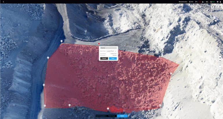
LiDAR can measure the location of points on a structure to acquire geometry data that can be used for building precise 3D models. LiDAR also provides volumetric data that can be used for detailed volume measurements of large structures or building materials. This capability is useful in construction projects where the primary goal is to create a digital representation of the project at hand, which could then be sent on to other engineers or architects who are working with different aspects of building design and construction.
LiDAR can also be used to generate accurate elevation models for use in construction plans. This is an essential tool in building new structures because it saves a tremendous amount of time on-site and reduces costs of mistakes due to misplacement.
Mapping
The LiDAR system provides highly detailed location data that can be used to create highly accurate maps. Operators can use this data in various applications, including creating detailed maps for autonomous vehicles or creating accurate digital models that allow for the study of earth from an overhead view.


Industrial Inspection
LiDAR is able to capture the geometry of physical structures as well as provide detailed surface information. This can be used in industrial inspection applications where it’s critical for engineers and operators to know the exact dimensions of a structure before they perform maintenance or work with dangerous equipment. Additionally, LiDAR can be used to prevent hazardous situations with electrical grids. One example of this is when LiDAR is used to map the vegetation that has grown up around power lines; letting electric companies know where they need to trim vegetation before it causes potential safety hazards.

Highly-Accurate Models of Complex Structures Are Possible With The L1
These are just a small sample of the many use cases LiDAR can assist with. This technology is something that until very recently was not accessible to the general public due to high cost, but the L1 system changes that entirely, opening the door for the development of even more use cases.
Final Thoughts

DJI has been a game-changer for the drone industry, and now they are doing the same for aerial surveying. The DJI Zenmuse L1 payload for the M300 RTK drone brings LiDAR to everyone who wants it; without breaking their budget or requiring professional installation services. Simply put, the DJI L1 is a LiDAR system for the masses. With an affordable price point and easy-to-use interface, this sensor can be used in a variety of applications, from mapping to forestry management.
If you’re looking into new ways that your business could benefit from LiDAR technology, contact us at contact@dronefly.com or visit our website at www.dronefly.com
For more information on the DJI Zenmuse L1, check out our YouTube video!

