


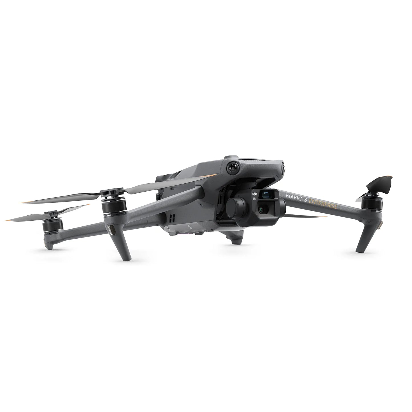
DJI Mavic 3 Enterprise
DJI Mavic 3 Enterprise

Couldn't load pickup availability


- Description
- Specifications
- In the Box
- FAQ
DJI Mavic 3 Enterprise: Professional compact surveying and inspection drone
The DJI Mavic 3 Enterprise (M3E) is the premier compact solution for commercial drone pilots requiring elite surveying and inspection capabilities. Built on a portable 915g frame, the M3E features a dual-camera system highlighted by a 20MP 4/3 CMOS wide-angle sensor.
This specialized camera utilizes a mechanical shutter and 0.7-second interval shooting to deliver high-speed mapping without image distortion. With an industry-leading 45-minute flight time and 56× hybrid zoom, this aircraft empowers professionals in construction, surveying, and public safety to achieve mission objectives with more precision and less equipment.
Supported by a comprehensive enterprise ecosystem, the M3E is a field-ready tool for the modern UAV operator.
Mavic 3 Enterprise features at a glance
- High-speed mapping: 0.7-second shooting interval and mechanical shutter for efficiency
- Survey-grade sensor: Features a 20MP 4/3 CMOS wide-angle camera
- Magnification reach: Tele camera supports up to 56x hybrid visual zoom
- Mission endurance: Fly for up to 45 minutes on a single charge
- Stable transmission: O3 Enterprise provides HD feeds up to 15 km
- Intelligent safety: Omnidirectional avoidance and APAS 5.0 for secure flight
- Professional control: Bundled RC Pro Enterprise with 1,000-nit high-brightness display
- Modular expansion: Supports RTK module and loudspeaker for specialized tasks
- Precision metadata: Centimeter-level positioning accuracy via modular RTK support

Optimized performance for high-accuracy surveying
The Mavic 3 Enterprise redefines professional efficiency by packing advanced mapping technology into a small, foldable airframe. The 4/3 CMOS sensor with large 3.3 µm pixels ensures high-quality imaging even in low-light conditions, while the mechanical shutter enables rapid data collection at speeds that would cause blur on consumer-grade drones.
For detailed inspections, the 56× hybrid zoom allows pilots to observe critical details from a safe distance, making it ideal for utility and infrastructure audits. Powered by DJI Pilot 2, the M3E allows teams to manage complex missions and data effortlessly, serving as a definitive asset for large-scale projects and emergency response.
System integration and support
- Enterprise ecosystem: Native integration with DJI FlightHub 2 and DJI Terra
- Modular hardware: Quick-attachment support for RTK and Loudspeaker modules
- Platform flexibility: Full support for PSDK and MSDK for custom solutions
- High-speed charging: Compatible with the 100W DJI battery charging hub
- Navigation stability: Uses quad-GNSS support (GPS, Galileo, BeiDou, and GLONASS)
- Cloud synchronization: Real-time data sharing via DJI Cloud API connectivity
Optimal image transmission
The DJI Mavic 3 Enterprise drone can fly farther and transmit signals with more stability thanks to DJI O3 Enterprise Transmission, which allows for a maximum control range of 15 km. This gives pilots more confidence when flying.
The aircraft also offers a 1080p/30fps high frame rate live broadcast. Transmission distance is a proxy for signal strength.
Flight safety a priority
DJI has always been at the forefront of the drone market in terms of creating cutting-edge safety features, and the DJI Mavic 3E carries on this tradition with better object detecting and navigation algorithms that provide drone pilots with the direction they need to remain safe.
The M3E drone has DJI AirSense, which collects ADS-B signals from surrounding conventional aircraft to alert drone pilots of nearby air activity.
Six omnidirectional fish-eye sensors are also installed, enabling the new and upgraded DJI APAS system 5.0 for obstacle detection with no blind spots.
Deployment scenarios and use cases
- Construction mapping: Capture high-resolution site data for frequent progress monitoring
- Utility inspection: Use 56x zoom to check power line components safely
- Surveying projects: Generate centimeter-accurate 2D and 3D maps using RTK
- Tactical response: Provide overhead situational awareness for ground teams rapidly
- Emergency missions: Assist in search efforts with long-duration 45-minute flights
- Land development: Survey large acreage efficiently with automated s-shaped routes
- Infrastructure audits: Perform detailed bridge or dam inspections from standoff distances
Engineered for enterprise operations
The Mavic 3 Enterprise is engineered to function as a compact, industry-leading solution that removes the traditional barriers to professional drone adoption. Its foldable design allows it to be deployed in seconds, while the advanced omnidirectional safety sensors ensure that pilots can operate confidently in complex environments.
By providing survey-grade accuracy in a 915g package, the M3E empowers teams to achieve their mission objectives with greater precision and significantly less logistical overhead than traditional large-scale systems.
Dronefly stands as your exclusive drone partner, ensuring that your enterprise team is equipped with the most efficient mapping technology available. Our Solutions Lifecycle Partnership Program provides the integrated hardware and software support required to keep your aerial operations on track.
Elevate your professional capabilities and achieve your operational goals by choosing the DJI Mavic 3 Enterprise from Dronefly.

