


Autel EVO Max 4N Bundle
Autel EVO Max 4N Bundle

Couldn't load pickup availability


- Description
- Specifications
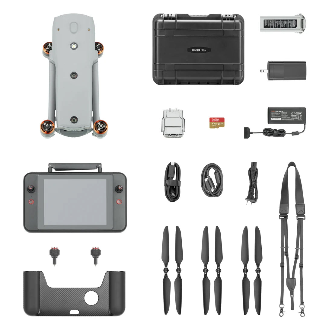
- In the Box
- FAQ
Unlock New Aerial Possibilities with the Autel EVO Max 4N
The Autel EVO Max 4N redefines what's possible with drones, offering groundbreaking capabilities that push performance limits. With cutting-edge technology and intelligent autonomy, it effortlessly navigates complex environments in real-time using 3D flight mapping.
Experience unparalleled obstacle avoidance and fly seamlessly even without a GPS signal-all within a foldable, weather-resistant design that ensures superior portability. Its advanced thermal imaging payload makes object detection and tracking more precise than ever.
Versatile and High-Performance Payload System
Designed for multiple applications, the EVO Max 4N features a detachable payload for quick replacements, upgrades, or repairs with just two screws. Here are some of its standout components:
- Starlight Camera
Capture night scenes with precision. This 2.3MP camera ensures clear, detailed imaging even in low-light environments.
- Wide Camera
Featuring a 50MP sensor, it records 4K 30fps video with a maximum ISO of 64000. The Moonlight Algorithm 2.0 enhances image quality by reducing noise and boosting HDR, delivering crisp, detailed visuals even in dim lighting.
- Thermal Camera
Offers high-resolution 640x512 thermal imaging with 30fps video and 16x digital zoom for superior thermal detection.
- Laser Rangefinder
Pinpoint target coordinates and altitude from up to 0.75 miles away with a single tap on the RC screen.
Navigate with Ease
The Autel Autonomy Engine collects environmental data to create dynamic 3D flight paths, allowing effortless navigation through challenging terrains like forests, buildings, and mountainous landscapes. Ideal for 3D scene reconstruction, public safety operations, industrial inspections, and land surveys.
Fly Without GPS
Advanced sensor technology enables the EVO Max 4N to operate in GPS-denied locations such as underground facilities or enclosed structures.
Precision Tracking and Identification
Autel's AI recognition system enables real-time object detection, tracking heat signatures, moving people, or vehicles from high altitudes-making it a powerful tool for law enforcement and surveillance.
Eliminate Blind Spots and Combat Interference
Integrating millimeter wave radar with traditional binocular vision, the EVO Max 4N detects objects as small as 0.5 inches, ensuring safe flight even in low-light conditions.
Its advanced flight control algorithms counteract RFI, EMI, and GPS spoofing, allowing safe operation near power lines, sensitive infrastructure, and rugged landscapes.
Build Your EVO Max Drone Network
Autel introduces A-Mesh 1.0, the industry's first drone-to-drone networking system. This innovative technology allows multiple EVO Max 4N drones to communicate, coordinate, and autonomously share data.
Unlike traditional chain-link systems, A-Mesh ensures continued operation even if one drone exits the network. Whether with or without LTE coverage, single or multiple pilots can manage entire drone fleets efficiently.
Data Security You Can Trust
Autel prioritizes data protection. The EVO Max 4N safeguards flight logs, location data, and user information with local-only access.
It supports AES-256 encryption for videos, images, and logs, ensuring that all data remains secure and password-protected.
Multiple Use Cases
The Autel EVO Max 4 is designed to be used by multiple industries for various use cases.
Law enforcement
- Subject monitoring & tracking
- General reconnaissance & intel gathering
- Disaster response
- Scene photography and reconstruction
- Pre-planning & situational response
Fire and rescue
- Identify fire lines
- Maintain fire breaks
- Inspection of structures & hot spots
- Visual access to areas with difficult terrain
- Identify impassable areas for support aircraft
Utilities and infrastructure
- Simplified tower inspection
- Power & pipeline inspection
- Wind turbine inspection
- Grid mapping & surveying
- Site patrol & security
Construction
- Site planning & evaluation
- Monitoring & tracking
- Progress reports, validation, & proof of execution
- Site patrol & security
Mining and mapping
- Planning & progress monitoring
- Volumetrics
- Change detection
- Remediation
- Safety, security, and surveillance
Content and media
- Real-time coverage of events
- Incident reconstruction & storytelling
- Photos & videos in hard to reach locations
- Content creation & cinematography
- Frequent updates & reports on key topics

