


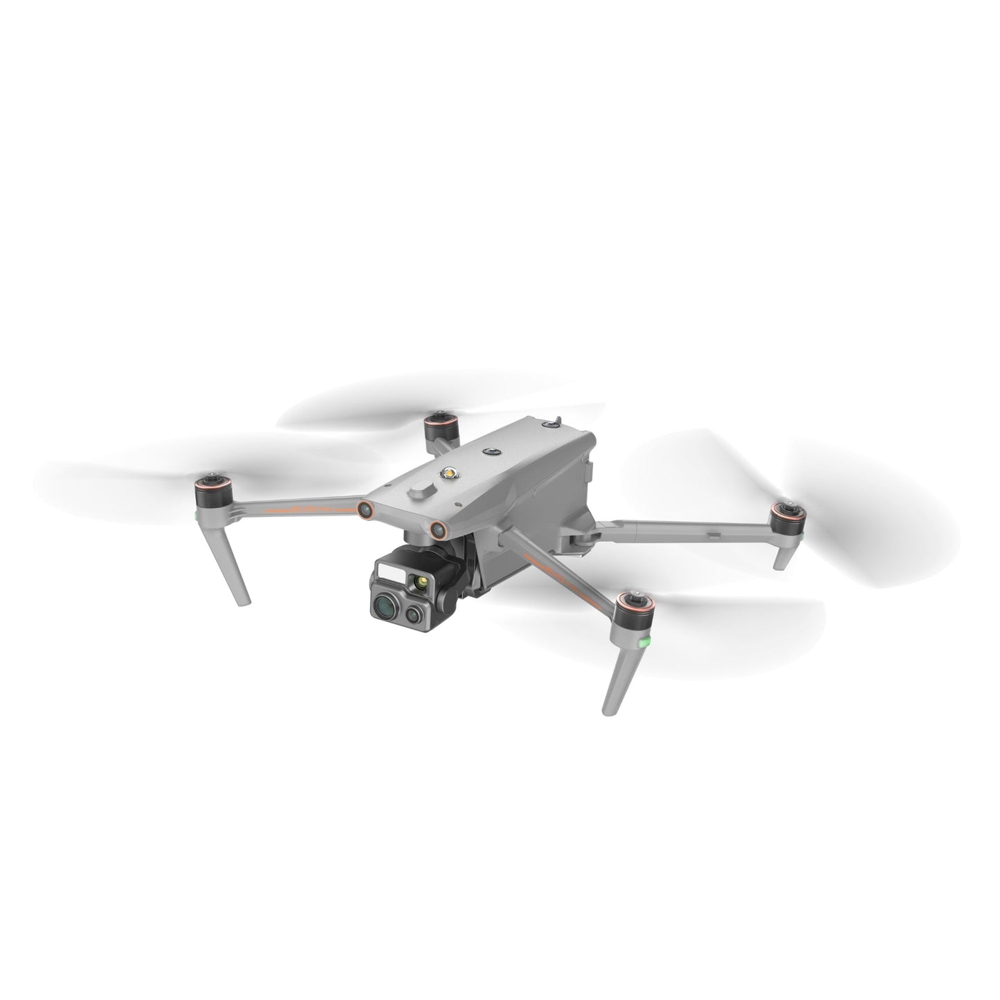
Autel EVO Max 4T XE (Nest Model)
Autel EVO Max 4T XE (Nest Model)

Couldn't load pickup availability


- Description
- Specifications
- In the Box
- FAQ
Autel EVO Max 4T XE (Nest Model): advanced multi-sensor autonomy for enterprise night and day missions
The Autel EVO Max 4T XE (Nest Model) delivers high-performance imaging, autonomous flight intelligence, and resilient communication for teams operating across demanding environments. Its FusionLight 4T XE gimbal integrates 8K zoom imaging, 50 MP wide-angle capture, 640 × 512 thermal detail, and long-range laser ranging to support public safety, inspection, and emergency workflows.
With 720° obstacle sensing, SLAM navigation, anti-interference architecture, and multi-aircraft A-Mesh networking, the EVO Max 4T XE provides reliable performance where visibility, GPS access, and signal conditions may be limited.
Core imaging and ranging capabilities
- Zoom sensor captures detailed 8K imagery with 10× optical capability
- Wide camera provides 50 MP clarity with strong low-light enhancement
- Thermal unit generates 640 × 512 heat imaging with 16× zoom levels
- Rangefinder records coordinate data accurately up to 0.75 miles
- Multi-sensor FusionLight suite supports combined thermal and RGB feeds
- Obstacle system detects micro-branches down to 0.5 inches
- Anti-jamming architecture stabilizes flight near interference sources
- SLAM navigation supports indoor and underground maneuvering
- SkyLink 3.0 provides long-range HD encrypted transmission capability
- Hot-swappable packs maintain continuous operational activity
Integrated sensor suite supporting high-value operations
The EVO Max 4T XE combines long-range zoom imaging, thermal detection, and wide-area optical capture into a single stabilized payload. The zoom camera delivers 8K resolution with 10× optical range and up to 160× hybrid zoom for identifying distant subjects.
The wide-angle camera provides 8K and 4K output with enhanced low-light performance. A radiometric thermal sensor reveals heat signatures with 16× digital zoom, and the rangefinder obtains precise coordinates up to 0.75 miles. Multi-channel projection supports simultaneous thermal, RGB, and wide feeds for rapid interpretation.
Autonomous intelligence enabling complex terrain navigation
Autel Autonomy generates live 3D models that guide automated flight routes through tight corridors, vertical structures, forested terrain, and urban environments. A 720° perception suite detects micro-obstacles down to 0.5 inches, ensuring stable navigation in rain, low light, or limited visibility.
Anti-jamming systems counter interference from power lines or urban EMI, while SLAM visual navigation maintains control in GNSS-denied conditions. A-Mesh networking enables relay flight, multi-drone collaboration, and BVLOS capability. SkyLink 3.0 streams encrypted 1080p60 video up to 12.4 miles for remote coordination.
Hardware and communication synergy
- Compatible with SkyLink 3.0 quad-band communication system
- Supports A-Mesh 1.0 multi-aircraft network operation
- Works with Smart Controller V3 for bright outdoor viewing
- Integrates with Autel Enterprise mission application suite
- Supports 4G LTE and AES-256 encrypted communication layers
- SDK support enables custom payload and workflow development
Operational field scenarios
- Public safety overwatch: maintain long-range awareness during patrol missions
- SAR deployments: detect heat signatures across rugged and obscured terrain
- Infrastructure surveys: examine towers, pipelines, and communication assets
- Industrial security patrols: oversee perimeter zones in challenging conditions
- Disaster response mapping: capture detailed assessments in restricted areas
- Tactical interior support: navigate confined structures using SLAM stability
- Mining evaluations: collect volumetric data in low-light work environments
- Environmental monitoring: observe ecological patterns without disturbance
- Construction documentation: record nighttime or low-light site progression
- Corridor inspection missions: navigate canopy or EMI-affected paths securely
Engineered for enterprise performance
The EVO Max 4T XE combines IP43 environmental protection, 27 mph wind resistance, and operation from –3 °F to 122 °F for dependable deployment. Its autonomous navigation, mesh networking capability, and multi-sensor suite provide reliable clarity and communication across dynamic missions. With rapid takeoff, secure data handling, and a versatile imaging payload, it supports long-term operational demands for enterprise teams.
The EVO Max 4T XE provides night and day operational support for agencies requiring precise imaging, autonomous flight, and secure communication pathways. Its rugged design and mapping intelligence deliver consistent performance across challenging scenarios.
Dronefly provides trusted West Coast expertise, enterprise integration support, and reliable after-purchase guidance. Order the EVO Max 4T XE (Nest Model) today to elevate your operational capability with proven multi-sensor performance.

