

DJI Matrice 4E Universal Edition (Used)
DJI Matrice 4E Universal Edition (Used)

Couldn't load pickup availability
- Description
- Specifications
- In the Box
- FAQ
DJI Matrice 4E Universal Edition (Used): Mapping-Grade Precision at Lower Cost of Entry
The DJI Matrice 4E Universal Edition (Used) delivers flagship mapping capability to your operation at a fraction of the new-unit cost, available here in inspected pre-owned condition verified to perform like new.
Combining a 4/3-inch CMOS wide camera with 48 MP medium tele and telephoto lenses, this aircraft captures 5-directional oblique imagery that DJI rates at up to a 40 percent efficiency gain over single-angle capture. Whether you're adding your first mapping platform or expanding an existing survey fleet, the M4E pairs a 49-minute flight time with 0.5-second interval shooting to move large-area data collection faster.
Key Features and Benefits
- Verified condition: unit inspected and confirmed to deliver like-new operating performance.
- Flight endurance: reaches 49 minutes on a single charge with standard props.
- Distortion-free mapping: 20 MP wide camera uses a mechanical shutter for accuracy.
- High-speed capture: 0.5-second intervals accelerate large-area field mapping data collection.
- Five-angle imaging: oblique capture lifts mapping efficiency by up to 40 percent.
- Sub-pixel accuracy: Distortion Correction 2.0 holds residual error under two pixels.
- RTK precision: centimeter-level positioning available without external ground control points.
- Integrated planning: Smart 3D Capture generates routes from the RC Plus 2.
- Full-speed sensing: omnidirectional avoidance operates at 21 m/s forward flight.
- Extended range: O4 Enterprise delivers live 1080p video up to 25 km.
Budget constraints should not mean settling for reduced mapping accuracy, and this verified used unit is built to prove that. Every core system performs to the same standard as new: sub-two-pixel distortion correction, factory-calibrated optics, centimeter-level RTK positioning, and omnidirectional obstacle avoidance for safer operation near structures.
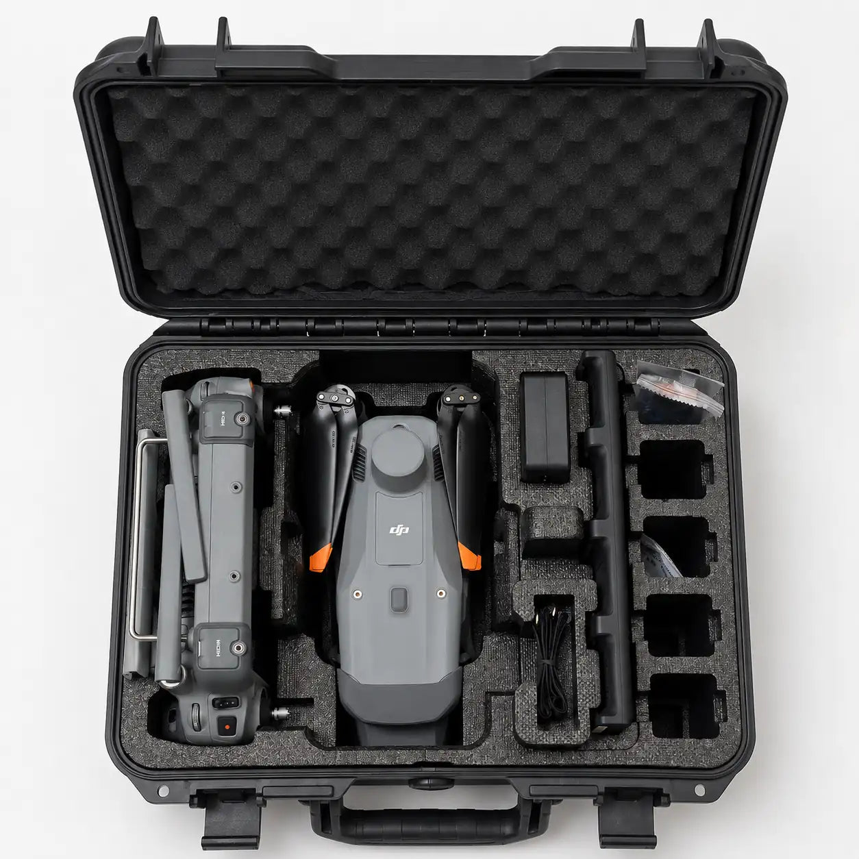
The complete standard kit ships with the aircraft, including the RC Plus 2 Enterprise controller, battery, 100W charging hub, and storage case, so your team can deploy without sourcing anything else first. As a used unit, this listing does not include the complimentary 1-year DJI Terra Pro license bundled with new purchases.
Accuracy That Doesn't Depend on a New Serial Number
Choosing pre-owned equipment should never mean gambling on data quality, which is why every unit in this listing is verified before it reaches an operator. The mechanical shutter on the wide camera eliminates rolling shutter distortion during forward flight, a detail that directly affects reconstruction accuracy in overlapping imagery.
Factory-calibrated optics and DJI Terra compatibility keep this platform producing clean, reconstruction-ready datasets with minimal manual correction. For an operation weighing new against used, this configuration delivers the same accuracy a new unit provides at a meaningfully lower cost of entry.
Compatibility and System Integration
- DJI RC Plus 2 Enterprise: standard controller ships with this unit (included).
- Matrice 4 Series Battery: one unit included with this configuration (included).
- 100W Charging Hub: standard sequential charger included with this used kit (included).
- DJI Terra: compatible mapping and reconstruction software platform (sold separately).
- Zenmuse and third-party PSDK payloads: connect through the E-Port interface (sold separately).
- DJI FlightHub 2: enables remote mission and fleet visibility tools (sold separately).
- DJI Cellular Dongle 2: adds 4G connectivity to the controller (sold separately).
Applications and Use Cases
- Large-scale topographic mapping: rapid capture intervals cover extensive survey areas quickly.
- Urban 3D modeling: oblique imaging captures full building facades for digital twins.
- Infrastructure and asset inspection: extended endurance supports bridges and pipeline surveys.
- Environmental and land monitoring: efficient coverage benefits coastline and forest projects.
- Disaster response operations: rapid on-site 3D mapping supports emergency logistics planning.
- Construction progress documentation: precise models track site development over time.
- Enterprise GIS data collection: RTK accuracy supports professional survey-grade deliverables.
The Matrice 4E exists to give survey and mapping teams flagship-grade accuracy without workflow compromises, and this verified used unit extends that value to a lower cost of entry. Inspected condition, factory-calibrated optics, and centimeter RTK positioning mean pre-owned doesn't mean a step down in what your deliverables can achieve.
Whether you're standing up your first mapping platform or adding capacity to an existing survey fleet, this verified used M4E gets you flagship performance without the new-unit price tag. Dronefly stocks inspected used enterprise drones for operators who want proven accuracy at better value. Shop the DJI Matrice 4E Universal Edition (Used) now at Dronefly.


