Skip to product information
1 of 4

DJI Matrice 4T (Demo Unit)

DJI Matrice 4T (Demo Unit)

Regular price $3,999.00
Regular price $7,799.00 Sale price $3,999.00
Sale Sold out
  • Demo unit in like-new condition, cosmetic engraving, fully operational thermal platform.
  • Six integrated sensors: thermal, wide, medium tele, tele, NIR light, and rangefinder.
  • Thermal camera with Super Resolution delivers images up to 1,280 × 1,024 resolution.
  • Wide camera captures 48 MP at f/1.7 for superior low-light RGB performance.
  • Laser rangefinder tags GPS coordinates on targets up to 1,800 m away.
  • AI detection identifies people, vehicles, and ships in real time during operations.
  • Gimbal tilts -90° to 70° for downward nadir and upward inspection coverage.
  • One-hundred-twelve times hybrid zoom resolves details from 250 m standoff distance.
  • O4 Enterprise transmission reaches 25 km range under FCC authorization.
View full details
  • Description
  • Specifications
  • In the Box
  • FAQ

DJI Matrice 4T (Demo Unit): Quad-Sensor Thermal Drone With 49-Minute Flight Time and 112× Hybrid Zoom

The DJI Matrice 4T is DJI's purpose-built thermal and public safety platform within the Matrice 4 Series: a compact, folding enterprise aircraft integrating six sensing modules on a single 3-axis stabilized gimbal—a 48 MP wide-angle camera at f/1.7, a 48 MP medium telephoto at 70 mm equivalent, a 48 MP telephoto at 168 mm equivalent with 112× hybrid zoom, a 640 × 512 uncooled VOx thermal imager with Super Resolution up to 1,280 × 1,024, a 1,800 m (5,906 ft) laser rangefinder, and a built-in NIR auxiliary light with 100 m illumination range.

The gimbal tilts from -90° to 70°, covering downward nadir through upward inspection angles, with all six sensors simultaneously active and instantly switchable without landing or reconfiguring the aircraft.

Key Features and Benefits

  • Quad-sensor imaging: 48 MP wide, 48 MP medium tele, 48 MP tele, and 640 × 512 thermal on one gimbal.
  • Thermal imaging: uncooled VOx sensor with High-Res Mode delivering up to 1,280 × 1,024 via Super Resolution.
  • Wide aperture: f/1.7 wide camera captures 48 MP frames with superior low-light RGB performance.
  • NIR auxiliary light: integrated illuminator provides 100 m near-infrared illumination for nighttime operations.
  • Laser rangefinder: tags GPS coordinates on targets at distances up to 1,800 m (5,906 ft).
  • AI detection: real-time identification of people, vehicles, and ships with custom model support.
  • Extended gimbal tilt: -90° to 70° range enables upward-looking angles for overhead infrastructure inspection.
  • Flight endurance: 49-minute flight time supports sustained overwatch, inspection, and response sorties.
  • Hybrid zoom: 112× zoom resolves license plates and fine structural details from 250 m (820 ft) standoff.
  • O4 Enterprise transmission: 25 km range (FCC) with 8-antenna system and 1080p/30fps live view.

This listing is for a like-new factory demo unit. A permanent factory engraving on the aircraft body reads "Demo Unit Not For Sale," with equivalent Chinese text. This is a cosmetic marking only and carries no effect on any flight system, imaging sensor, thermal camera, AI detection capability, or software function.

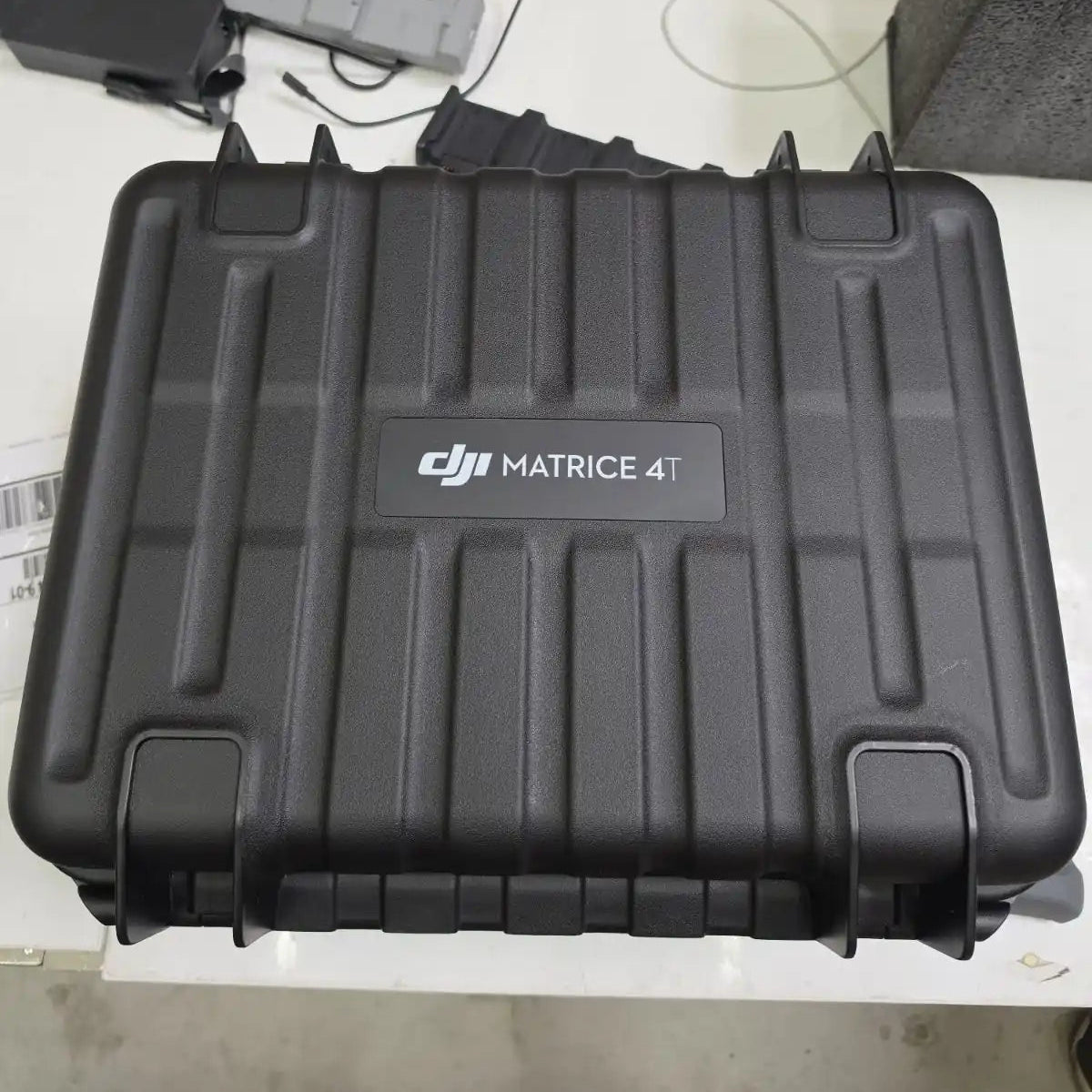
The aircraft is mechanically and electronically identical to a standard production M4T. Included: one Matrice 4 Series Intelligent Flight Battery, three propeller pairs, the DJI RC Plus 2 Enterprise Edition controller, charger, charging hub, and the official DJI Matrice 4T carry case. The M4T does not carry an IP ingress protection rating and is not designed for operation in rain or wet conditions.

A Multi-Sensor Platform Configured for Operational Continuity

Fleet integrators and program managers evaluating the M4T are evaluating a system designed around a specific operational constraint: crews cannot afford payload swaps mid-mission.

The M4T addresses this by consolidating all six sensing modules into a single gimbal architecture that keeps every sensor available at all times. Thermal overwatch, visual confirmation via 112× zoom, GPS coordinate tagging, NIR illumination, and temperature measurement across a range of -20°C to 550°C (-4°F to 1,022°F) are all accessible from the controller without interrupting the flight.

AI-powered real-time detection of people, vehicles, and ships further reduces crew workload during high-tempo operations. For inspection programs, the gimbal's 70° upward tilt extends coverage to overhead structures, tower cross-members, and underside infrastructure without repositioning the aircraft, reducing total sortie count and flight time per site.

Compatibility and System Integration

  • DJI FlightHub 2: cloud-based fleet management platform for live control, mission coordination, and multi-aircraft oversight.
  • DJI Pilot 2 app: primary flight operations and mission planning interface for all M4T workflows.
  • DJI AL1 Spotlight: gimbal-following visible-light spotlight for nighttime scene illumination via E-Port interface.
  • DJI AS1 Speaker: real-time voice broadcast accessory for ground interaction during active flight operations.
  • D-RTK 3 Multifunctional Station: differential correction base station for centimeter-level RTK positioning.
  • DJI Cellular Dongle 2: optional 4G/LTE module enabling network RTK access and expanded connectivity.
  • RC Plus 2 Enterprise Enhanced Edition: optional upgraded controller with expanded industry accessory compatibility.
  • Payload SDK and Cloud API: enable third-party PSDK device integration and custom enterprise data workflows.

Applications and Use Cases

  • Search and rescue: thermal detection locates heat signatures while zoom and rangefinder confirm subject GPS coordinates.
  • Law enforcement and public safety: 112× hybrid zoom identifies individuals and vehicles from safe operational distances.
  • Power line and tower inspection: 70° upward tilt and medium telephoto resolve wire faults and hardware defects at height.
  • Wildfire overwatch: thermal imaging tracks fire perimeters and hot spots through smoke across wide operational areas.
  • Critical infrastructure inspection: NIR illumination and telephoto zoom document structural conditions in low-light environments.
  • Wildlife monitoring: integrated NIR light and thermal imaging support nighttime population surveys without ground disturbance.

The Matrice 4T is configured for programs where a single aircraft must cover visual, thermal, and near-infrared data requirements across the full duration of a deployment without landing between capability switches. Its six-module gimbal architecture makes it a durable foundation for public safety fleets, inspection programs, and emergency response units that need consistent multi-sensor coverage across varied and unpredictable mission profiles.

Dronefly's enterprise team works directly with fleet managers, program directors, and public safety coordinators to configure M4T systems around specific operational requirements, accessory loadouts, and software integration plans.

This like-new demo unit offers access to DJI's thermal flagship at a reduced acquisition cost with no reduction in platform capability. Contact Dronefly to discuss deployment configuration and available accessory pairings.

Aircraft

  • Takeoff Weight (with propellers): 1219 g* - *The standard weight of the aircraft (including the battery, propellers, and a microSD card). The actual product weight may vary due to differences in batch materials and external factors.
  • Takeoff Weight (with Low-Noise propellers): 1229 g* - *The standard weight of the aircraft (including the battery, propellers, and a microSD card). The actual product weight may vary due to differences in batch materials and external factors.
  • Max Takeoff Weight: Standard Propellers: 1420 g, Low-Noise Propellers: 1430 g
  • Dimensions: Folded: 260.6×113.7×138.4 mm (L×W×H), Unfolded: 307.0×387.5×149.5 mm (L×W×H), Maximum dimensions excluding propellers.
  • Max Payload: 200 g
  • Propeller Size: 10.8 in
  • Diagonal Wheelbase: 438.8 mm
  • Max Ascent Speed: 10 m/s
  • Maximum Ascent Speed With Accessories: 6 m/s
  • Max Descent Speed: 8 m/s
  • Max Descent Speed With Accessories: 6 m/s
  • Max Horizontal Speed (at sea level, no wind): 21 m/s, 21 m/s flying forward, 18 m/s flying backward, 19 m/s flying sideways. No faster than 19 m/s with Sport mode in EU regions.
  • Max Altitude: 6000 m
  • Max Operating Altitude with Payload: 4000 m
  • Max Flight Time (without wind): 49 min (standard propellers), 46 min (low-noise propellers). Measured with the aircraft flying at approximately 8 m/s without payloads in a windless environment until the battery level reached 0%. Data is for reference only. Actual usage time may vary depending on the flight mode, accessories, and environment.
  • Max Hover Time (without wind): 42 min (standard propellers), 39 min (low-noise propellers). Measured with the aircraft flying at approximately 8 m/s without payloads in a windless environment until the battery level reached 0%. Data is for reference only. Actual usage time may vary depending on the flight mode, accessories, and environment.
  • Max Flight Distance (no wind): 35 km (standard propellers), 32 km (low-noise propellers). Measured by the aircraft hovering in a windless environment at sea level, from 100% battery level until 0%.
  • Max Wind Speed Resistance: 12 m/s** Max wind speed resistance during takeoff and landing.
  • Max Pitch Angle: 35°
  • Operating Temperature: -10℃ to 40℃ (14°F to 104°F)
  • GNSS: GPS + Galileo + BeiDou + GLONASS** GLONASS is supported only when the RTK module is enabled.
  • Hovering Accuracy Range (windless or breezy): ±0.1 m (with Vision System); ±0.5 m (with GNSS); ±0.1 m (with RTK)
  • RTK GNSS Accuracy: RTK Fix: 1 cm + 1 ppm (horizontal), 1.5 cm + 1 ppm (vertical)
  • Internal Storage: N/A
  • Ports: E-Port interface × 1: Supports official accessories and third-party PSDK devices (hot-swapping is not supported). E-Port Lite interface × 1: supports USB connection to DJI tuning software and some third-party PSDK devices. Accessories or expansion modules must be installed before powering on.
  • Propeller Model: 1157F (standard propellers), 1154F (low noise propeller)
  • Beacon: Built into the aircraft

Camera

  • Image Sensor: DJI Matrice 4T Wide: 1/1.3-inch CMOS, Effective Pixels: 48 MP, Medium Tele Camera: 1/1.3-inch CMOS, Effective Pixels: 48 MP, Telephoto: 1/1.5-inch CMOS, Effective Pixels: 48 MP, DJI Matrice 4E Wide: 4/3-inch CMOS, Effective Pixels: 20 MP, Medium Tele Camera: 1/1.3-inch CMOS, Effective Pixels: 48 MP, Telephoto: 1/1.5-inch CMOS, Effective Pixels: 48 MP
  • Lens: DJI Matrice 4T FOV: 82°, Equivalent Focal Length: 24 mm, Aperture: f/1.7, Focus: 1 m to ∞, DJI Matrice 4E FOV: 84°, Equivalent Focal Length: 24 mm, Aperture: f/2.8-f/11, Focus: 1 m to ∞, Medium Tele Camera FOV: 35°, Equivalent Focal Length: 70 mm, Aperture: f/2.8, Focus: 3 m to ∞, Tele camera FOV: 15°, Equivalent Focal Length: 168 mm, Aperture: f/2.8, Focus: 3 m to ∞
  • ISO Range: Normal Mode: ISO 100 to ISO 25600, Night Scene Mode: Matrice 4T: Wide Camera: ISO 100 to ISO 409600, Medium Tele Camera: ISO 100 to ISO 409600, Tele Camera: ISO 100 to ISO 819200, Matrice 4E: Wide Camera: ISO 100 to ISO 204800, Medium Tele Camera: ISO 100 to ISO 409600, Tele Camera: ISO 100 to ISO 409600
  • Shutter Speed: DJI Matrice 4T 2-1/8000 s, DJI Matrice 4E Wide: Electronic Shutter: 2-1/8000 s, Mechanical Shutter: 2-1/2000 s, Medium Telephoto: 2-1/8000 s, Telephoto: 2-1/8000 s
  • Max Photo Size: DJI Matrice 4T Wide: 8064 × 6048, Medium Telephoto: 8064 × 6048, Telephoto: 8192 × 6144, DJI Matrice 4E Wide: 5280 × 3956, Medium Telephoto: 8064 × 6048, Telephoto: 8192 × 6144
  • Minimum Photo Interval: DJI Matrice 4T: 0.7 s, DJI Matrice 4E: 0.5 s
  • Still Photography Modes: DJI Matrice 4T: Wide: Single: 12 MP/48 MP, Interval: 12 MP/48 MP, JPEG: 0.7/1/2/3/5/7/10/15/20/30/60 s, Smart Shooting: 12MP, Panorama: 12 MP (raw image), 100 MP (stitched image), Medium Tele Camera: Single: 12 MP and 48 MP, Interval: 12 MP/48 MP, JPEG: 0.7/1/2/3/5/7/10/15/20/30/60 s, Smart Shooting: 12MP, Telephoto: Single: 12 MP and 48 MP, Interval: 12 MP/48 MP, JPEG: 0.7/1/2/3/5/7/10/15/20/30/60 s, Smart Shooting: 12MP, DJI Matrice 4E: Single: 20 MP, Interval: 20 MP, JPEG: 0.5/0.7/1/2/3/5/7/10/15/20/30/60 s, JPEG + RAW: 2/3/5/7/10/15/20/30/60 s, Smart Shooting: 20 MP, Panorama: 20 MP (raw image), 100 MP (stitched image), Medium Tele Camera: Single: 12 MP and 48 MP, Interval: 12 MP/48 MP, JPEG: 0.5/0.7/1/2/3/5/7/10/15/20/30/60 s, Smart Shooting: 12 MP, Telephoto: Single: 12 MP and 48 MP, Interval: 12 MP/48 MP, JPEG: 0.5/0.7/1/2/3/5/7/10/15/20/30/60 s, Smart Shooting: 12 MP
  • Video Codec and Resolution: Video Coding Format: H.264/H.265, Coding Strategy: CBR, VBR, Resolution: 4K: 3840 × 2160@30fps, FHD: 1920 × 1080@30fps
  • Max Video Bitrate: H.264: 60Mbps, H.265: 40Mbps
  • Supported File System: exFAT
  • Photo Format: DJI Matrice 4T: JPEG, DJI Matrice 4E: Wide: JPEG/DNG (RAW), Medium Tele Camera: JPEG, Telephoto: JPEG
  • Video Format: MP4 (MPEG-4 AVC/H.264)
  • Digital Zoom: Telephoto: 16x (112x hybrid zoom)

NIR Auxiliary Light

  • Infrared Illumination: DJI Matrice 4T: FOV: 5.7°±0.3°

Laser Module

  • Laser Rangefinding: Measurement Range: 1800 m (1 Hz) @20% reflectivity target* Oblique Incidence Range (1:5 Oblique Distance): 600 m (1 Hz) Blind Zone: 1 m Distance Measurement Accuracy: 1-3 m: System Error <0.3 m, Random Error <0.1 meters @1σ Other Distances: ±(0.2+0.0015D) (D represents the measurement distance in meters) * Performance degradation may occur in rainy or foggy conditions

Infrared Thermal Camera

  • Thermal Imager: DJI Matrice 4T: uncooled vanadium oxide (VOx) DO NOT expose the infrared camera lenses to strong sources of energy such as the sun, lava, or a laser beam. Otherwise, the camera sensor may be burned leading to permanent damage.
  • Resolution: DJI Matrice 4T: 640 × 512
  • Pixel Pitch: DJI Matrice 4T: 12 μm
  • Frame Rate: DJI Matrice 4T: 30 Hz
  • Lens: DJI Matrice 4T DFOV: 45°±0.3°, DJI Matrice 4T equivalent focal length: 53 mm, DJI Matrice 4T Aperture: f/1.0, DJI Matrice 4T Focus: 5 m to ∞
  • Sensitivity: DJI Matrice 4T: ≤50mk@F1.0
  • Temperature Measurement Method: DJI Matrice 4T: Spot Meter, Area Measurement
  • Temperature Measurement Range: DJI Matrice 4T: High Gain Mode: -20℃ to 150℃ (-4°F to 302°F), Low Gain Mode: 0℃ to 550℃ (32°F to 1022°F)
  • Palette: DJI Matrice 4T: White Hot/Black Hot/Tint/Iron Red/Hot Iron/Arctic/Medical/Fulgurite/Rainbow 1/Rainbow 2
  • Photo Format: DJI Matrice 4T: JPEG (8bit), R-JPEG (16bit)
  • Video Resolution: DJI Matrice 4T: 1280 × 1024@30fps (Super Resolution enabled, Night Mode not activated), Other conditions: 640 × 512@30fps
  • Video Bitrate: DJI Matrice 4T: 6.5Mbps (H.264 640 × 512@30fps), 5Mbps (H.265 640 × 512@30fps), 12Mbps (H.264 1280 × 1024@30fps), 8Mbps (H.265 1280 × 1024@30fps)
  • Video Format: DJI Matrice 4T: MP4
  • Still Photography Modes: DJI Matrice 4T: Single: 1280 × 1024/640 × 512, Interval: 1280 × 1024/640 × 512, JPEG: 0.7/1/2/3/5/7/10/15/20/30/60 s
  • Photo Resolution: DJI Matrice 4T: Infrared: 1280 × 1024 (Super Resolution on), 640 × 512 (Super Resolution off)
  • Digital Zoom: DJI Matrice 4T: 28x
  • Infrared Wavelength: DJI Matrice 4T: 8um to 14um
  • Infrared Temperature Measurement Accuracy: DJI Matrice 4T: High Gain: ±2℃ or ±2%, whichever is greater, DJI Matrice 4T: Low Gain: ±5℃ or ±3%, whichever is greater

Gimbal

  • Stabilization System: DJI Matrice 4T: 3-axis (tilt, roll, pan), DJI Matrice 4E: 3-axis (tilt, roll, pan)
  • Mechanical Range: DJI Matrice 4T Gimbal Mechanical Limits: Tilt: -140° to 113°, Roll: -52° to 52°, Pan: -65° to 65°, Soft Limits: Tilt: -90° to 35°, Roll: -47° to 47°, Pan: -60° to 60°, DJI Matrice 4E Gimbal Mechanical Limits: Tilt: -140° to 50°, Roll: -52° to 52°, Pan: -65° to 65°, Soft Limits: Tilt: -90° to 35°, Roll: -47° to 47°, Pan: -60° to 60°
  • Controllable Rotation Range: DJI Matrice 4T: Pan: ±-90° to 35°, Pan: Not controllable, DJI Matrice 4E: Tilt: -90° to 35°, Pan: Not controllable
  • Max Control Speed (tilt): 100°/s
  • Angular Vibration Range: ±0.007°
  • Yaw Axis: Manual operation is uncontrollable. The MSDK interface program is controllable.
  • Ingress Protection Rating: No Standard Protection Level
  • Operating Temperature: Standard: -10°C to 40°C (14°F to 104°F)

Sensing

  • Sensing Type: Omnidirectional binocular vision system, supplemented with a 3D infrared sensor at the bottom of the aircraft.
  • Forward: Binocular Measurement Range: 0.4-22.5 m, Measurement Range: 0.4-200 m, Obstacle Avoidance Speed: Flight Speed ≤21 m/s, FOV: 90° (horizontal), 135° (vertical)
  • Backward: Measurement Range: 0.4-22.5 m, Measurement Range: 0.4-200 m, Obstacle Avoidance Speed: Flight Speed ≤21 m/s, Field of View (FOV): 90° (horizontal), 135° (vertical)
  • Lateral: Measurement Range: 0.5-32 m, Measurement Range: 0.5-200 m, Obstacle Avoidance Speed: Flight Speed ≤21 m/s, FOV: 90° (horizontal), 90° (vertical)
  • Downward: Measurement Range: 0.3-18.8 m, Obstacle Avoidance Speed: Flight Speed ≤10 m/s, The FOV to the front and rear is 160° and 160° to the right and left.
  • Operating Environment: Forward, Backward, Left, Right, and Upward: Delicate texture on the surface, adequate light. Downward: The ground has rich textures and sufficient lighting conditions*, with a diffuse reflection surface and a reflectivity greater than 20% (such as walls, trees, people, etc.). * Sufficient lighting conditions refer to an illuminance not lower than that of a nighttime city light scene.

Video Transmission

  • Video Transmission System: O4 Enterprise
  • Live View Quality: Remote Controller: 1080p/30fps
  • Operating Frequency: 2.400-2.4835 GHz, 5.725-5.850 GHz, 5.150-5.250 GHz (CE), Operating frequency allowed varies among countries and regions. Refer to local laws and regulations for more information.
  • Transmitter Power (EIRP): 2.4 GHz: ≤33 dBm (FCC), ≤20 dBm (CE/SRRC/MIC), 5.8 GHz: <33 dBm (FCC), <30 dB (SRRC), <14 dBm (CE), 5.15-5.25: <23 dBm (FCC/CE)
  • Max Transmission Distance (unobstructed, free of interference): 25 km (FCC), 12 km (CE), 12 km (SRRC), 12 km (MIC). Measured in an unobstructed environment free of interference. The above data shows the farthest communication range for one-way, non-return flights under each standard. During your flight, please pay attention to RTH reminder on the DJI Pilot 2 app.
  • Max Transmission Distance (with interference): Strong Interference - City Centers (approx. 1.5-5 km), Medium Interference - Suburban Areas (approx. 5-15 km), Micro interference: Suburbs/Seasides (approx. 15-25 km). * Data is tested under FCC standards in unobstructed environments of typical interference. Only to serve as a reference and provides no guarantee as to the actual flight distance.
  • Max Download Speed: 20 MB/s. The above data was measured under conditions where the aircraft and remote controller were in close proximity without interference.
  • Latency (depending on environmental conditions and mobile device): 130 ms. Under near-field interference-free conditions, the Latency performance when shooting with a 1x lens.
  • Antenna: 8 antennas, 2T4R
  • Others: Cellular Dongle Compartment

Memory Card

  • Supported SD Cards: U3/Class10/V30 or above is required, or use a memory card from the recommended list.
  • Recommended microSD Cards: Lexar 1066x 64GB U3 A2 V30 microSDXC, Lexar 1066x 128GB U3 A2 V30 microSDXC, Lexar 1066x 256GB U3 A2 V30 microSDXC, Lexar 1066x 512GB U3 A2 V30 microSDXC, Kingston Canvas GO! Plus 64GB U3 A2 V30 microSDXC, Kingston Canvas GO! Plus 128GB U3 A2 V30 microSDXC, Kingston Canvas GO! Plus 256GB U3 A2 V30 microSDXC, Kingston Canvas GO! Plus 512GB U3 A2 V30 microSDXC

Intelligent Flight Battery

  • Capacity: 6741 mAh
  • Standard Voltage: 14.76 V
  • Max Charging Voltage: 17.0 V
  • Cell Type: Li-ion 4S
  • Energy: 99.5 Wh
  • Weight: 401 g
  • Recharging Temperature: 5°C to 40°C (41°F to 104°F)
  • Discharge Rate: 4C
  • Max Charging Power: 1.8C
  • Supports low-temperature charging: Not supported
  • Cycle Count: 200

Power Adapter (100W)

  • Input: 100-240 V (AC), 50-60 Hz, 2.5 A
  • Output: Max. 100 W (total). When both ports are used, the max output power of one port is 82 W, and the charger will dynamically allocate the output power of the two ports according to the power load.
  • Rated Power: 100 W

Charging Hub

  • Input: USB-C: 5-20 V, max 5 A
  • Output: Battery Interface: 11.2 V to 17 V
  • Rated Power: 100 W
  • Recharging Type: 4 batteries charging in sequence. Support Standard Mode (100% SOC) and Standby Mode (90% SOC)
  • Compatible Battery: DJI Matrice 4E/T Series Intelligent Flight Battery
  • Charging Temperature: 5° to 40°C (41°F to 104°F)

DJI RC Plus 2 Enterprise

  • Video Transmission System: O4 Enterprise
  • Max Transmission Distance (unobstructed, free of interference): 25 km (FCC), 12 km (CE), 12 km (SRRC), 12 km (MIC). Measured in an unobstructed environment free of interference. The above data shows the farthest communication range for one-way, non-return flights under each standard. During your flight, please pay attention to RTH reminder on the DJI Pilot 2 app.
  • Operating Band of Image Transmission: 2.4000-2.4835 GHz, 5.725 - 5.850 GHz, 5.1GHz (receive only). Operating frequency allowed varies among countries and regions. Refer to local laws and regulations for more information.
  • Antenna: 2T4R, built-in multi-beam high-gain antenna
  • Video Transmission Transmitter Power (EIRP): 2.4 GHz: <33 dBm (FCC), <20 dBm (CE/SRRC/MIC), 5.1 GHz: <23 dBm (CE), 5.8 GHz: <33 dBm (FCC), <14 dBm (CE), <30 dBm (SRRC)
  • 4G Transmission: DJI Cellular Dongle 2
  • Wi-Fi Protocol: Wi-Fi Direct, Wireless Display, IEEE 802.11a/b/g/n/ac/ax, Support 2 × 2 MIMO Wi-Fi, Dual Band Simultaneous (DBS) with dual MAC, up to 1774.5 Mbps data rate (2 × 2 + 2 × 2 11ax DBS)
  • Wi-Fi Operating Band: 2.4000-2.4835 GHz, 5.150-5.250 GHz. 5.8 and 5.2GHz frequencies are prohibited in some countries. In some countries, the 5.2GHz frequency is only allowed for use in indoor.
  • Wi-Fi Transmitter Power (EIRP): 2.4 GHz: <26 dBm (FCC), <20 dBm (CE/SRRC/MIC), 5.1 GHz: <23 dBm (FCC), 5.8 GHz <23 dBm (FCC/SRRC), <14 dBm (CE)
  • Bluetooth Protocol: Bluetooth 5.2
  • Bluetooth Operating Frequency: 2.400-2.4835 GHz
  • Bluetooth Transmitter Power (EIRP): <10 dBm
  • Screen Resolution: 1920 × 1200
  • Screen Size: 7.02 inches
  • Screen Frame Rate: 60 fps
  • Brightness: 1400 nits
  • Touchscreen Control: 10 Points Multi-touch
  • Built-in Battery: 2S2P High Energy Density 18650 Lithium-ion Battery (6500 mAh @ 7.2 V) 46.8 Wh
  • External Battery: Optional, WB37 (4920 mAh @ 7.6 V) 37 Wh
  • Recharging Type: Supports PD fast charging, with a maximum specification of 20 V/3.25 A USB Type-C charger.
  • Storage Capacity: ROM 128 G + expandable storage via microSD card
  • Charging Time: 2 hrs for internal battery or internal and external battery. When remote controller is powered off and using a standard DJI charger.
  • Internal Battery Runtime: 3.8 hrs
  • External Battery Runtime: 3.2 hrs
  • Output Port: HDMI 1.4
  • Indicators: Status light & power light & permission light, three-color light, brightness can be adjusted according to ambient brightness.
  • Speaker: Supports buzzer
  • Audio: Array MIC
  • Operating Temperature: -20° to 50° C (-4°F to 122°F)
  • Storage Temperature: Within one month: -30° to 45° C (-22°F to 113°F), One to three months: -30° to 35° C (-22°F to 95°F), Three months to one year: -30° to 30° C (-22°F to 86°F)
  • Recharging Temperature: 5° to 40° C (41°F to 104°F)
  • Supported Aircraft Models: Support for Matrice 4T/4E

AL1 Spotlight

  • Weight: 99 g (including bracket), Approx. 91 g (excluding bracket)
  • Dimensions: 95×164×30 mm (L×W×H, including bracket), 79×164×28 mm (L×W×H, without bracket)
  • Max. Power: 32 W
  • Illuminance: 4.3±0.2 lux @ 100 meters, 17±0.2 lux @ 50 meters. The data was measured in a laboratory environment with the spotlight installed separately on the aircraft at an ambient temperature of 25°C.
  • Effective Illumination Angle: 23° (10% relative illumination)
  • Effective Illumination Area: 1,300 square meters @ 100 meters (10% relative illumination, Normal Mode), 2,200 square meters @ 100 meters (10% central illuminance, Wide FOV Mode)
  • Operating Mode: Supports always-on and strobe modes.
  • Gimbal Structural Design Range: Tilt: -140° to 50°
  • Controllable Range: Tilt: -90° to 35°
  • Max Control Speed (tilt): 120°/s
  • Gimbal Alignment Accuracy: ±0.1°
  • Operating Temperature: -20°C to 50°C (-4°F to 122°F)
  • Mounting: Quick-release hand-tightened screws

AS1 Speaker

  • Weight: 92.5 g (including bracket), Approx. 90 g (excluding bracket)
  • Dimensions: 73×70×52 mm (L×W×H, including bracket), 73×70×47 mm (L×W×H, without bracket)
  • Max. Power: 15 W
  • Max. Volume: At 1 meter, it can reach 114 decibels (114dB@1m). Data measured in a laboratory environment at 25℃. Actual conditions may vary slightly due to software version, audio source, specific environment, and other factors. The final effect is subject to actual use.
  • Effective Broadcast Distance: 300 m. Data measured in a laboratory environment at 25℃. Actual conditions may vary slightly due to software version, audio source, specific environment, and other factors. The final effect is subject to actual use.
  • Broadcast Mode: Real-time broadcasting (supports echo suppression*), recorded broadcasting, media import (supports simultaneous transmission and playback), text-to-speech*** Need to upgrade to the latest firmware. ** Currently only supports Chinese and English.
  • Operating Temperature: -20°C to 50°C (-4°F to 122°F)
  • Mounting: Quick-release hand-tightened screws
  • 1x Matrice 4T aircraft (demo unit, "Demo Unit Not For Sale" engraved on body)
  • 1x DJI RC Plus 2 Enterprise Edition remote controller
  • 1x Matrice 4 Series Intelligent Flight Battery (6,741 mAh / 99.5 Wh)
  • 3x propeller pairs (in individual bags)
  • 1x charger (100W power adapter)
  • 1x charging hub
  • 1x official DJI Matrice 4T hard carry case
  • Cables and accessories
  • 1x pry bar
  • Manuals / documentation
What does "demo unit" mean for the Matrice 4T, and does the engraving affect platform capability?

This aircraft was produced by DJI as an authorized dealer demonstration unit and has never been offered as a standard retail sale. Its condition is like new. A permanent factory engraving on the body reads "Demo Unit Not For Sale," with equivalent Chinese text. This is a cosmetic marking only and has no effect on flight systems, thermal imaging, visible cameras, AI detection, NIR illumination, laser rangefinder, obstacle sensing, or software compatibility. All published DJI Matrice 4T specifications apply to this unit in full.

How does the six-module gimbal architecture support multi-sensor mission workflows?

All six sensing modules — wide camera, medium telephoto, telephoto, thermal imager, laser rangefinder, and NIR auxiliary light — are integrated into a single 3-axis stabilized gimbal and remain simultaneously active throughout the flight. Operators can switch between sensors instantly from the RC Plus 2 controller without landing or modifying the aircraft configuration. This eliminates the payload swap time that multi-sensor missions typically require, keeping the aircraft on station and the crew focused on the mission rather than equipment management.

Does the Matrice 4T carry an IP rating, and what environments is it suited for?

No. The DJI Matrice 4T does not carry an IP ingress protection rating and is not designed for operation in rain, heavy moisture, or dusty environments. Mission planning should account for weather conditions, and the aircraft should not be flown in precipitation. Program managers evaluating the M4T for all-weather deployments should contact Dronefly to discuss platforms with certified IP ratings that may better suit those operational requirements.

What is the thermal camera's temperature measurement range, and how accurate is it?

The M4T thermal sensor measures temperature across two gain modes. High Gain Mode covers -20°C to 150°C (-4°F to 302°F) with accuracy of ±2°C or ±2%, whichever is greater. Low Gain Mode extends coverage to 0°C to 550°C (32°F to 1,022°F) with accuracy of ±5°C or ±3%, whichever is greater. Each unit undergoes factory temperature calibration and includes an onboard temperature sensor for real-time compensation during flight. Measurement methods include Spot Meter and Area Measurement for both point and zone-based thermal analysis.

What is the difference between the RC Plus 2 Enterprise Edition and the Enhanced Edition, and which is included?

This listing includes the DJI RC Plus 2 Enterprise Edition, the standard controller for the Matrice 4 Series, which fully supports all M4T flight operations, thermal imaging, AI detection, and mission planning workflows. The RC Plus 2 Enterprise Enhanced Edition adds expanded interface components for compatibility with a broader range of industry accessories and is available as a separate purchase through Dronefly. For most public safety, inspection, and emergency response programs, the standard Enterprise Edition provides complete operational capability. Contact Dronefly's enterprise team if your configuration requires the Enhanced Edition.

What are the main camera/sensor payloads on the Matrice 4T?
  • Wide-angle: 1/1.3″ CMOS, 48 MP, f/1.7, equivalent ~24 mm.
  • Medium telephoto: 1/1.3″ CMOS, 48 MP, ~70mm eq.
  • Telephoto: 1/1.5″ CMOS, 48 MP, ~168mm eq.
  • Thermal camera: VOx uncooled sensor, resolution up to 1280×1024 in High-Res Mode.
Can the Matrice 4T be used for surveying/mapping work?

Yes. Although the 4E is more optimized for high-precision surveying, the 4T is capable of many mapping workflows (multicamera, oblique/orthophoto capture) while also adding thermal/inspection capability.

What is the main difference between the Matrice 4E and Matrice 4T?

The Matrice 4E and Matrice 4T share the same airframe, many common features and flight performance, but differ primarily in their camera/ sensor payloads.

  • The Matrice 4E is optimized for surveying/mapping: it features a 4/3-inch CMOS 20 MP wide-angle camera (mechanical shutter), plus the 48 MP medium-tele and 48 MP telephoto cameras.
  • The Matrice 4T replaces the wide-angle 4/3″ camera with a 1/1.3″ 48 MP wide camera, and adds a thermal imaging sensor, making it more suited for inspections, public safety or emergency response.
  • Both have similar flight time (~49 minutes) and core specs.

So if your focus is mapping/surveying, the 4E is ideal. If you need thermal imaging/inspections, the 4T is better.