

Inspired Flight IF800 Sentera 6X Multispectral Camera Payload
Inspired Flight IF800 Sentera 6X Multispectral Camera Payload

Couldn't load pickup availability
- Description
- Specifications
- In the Box
- FAQ
Sentera 6X Multispectral Camera Payload for IF800: Science-Grade Vegetation Data in One Flight
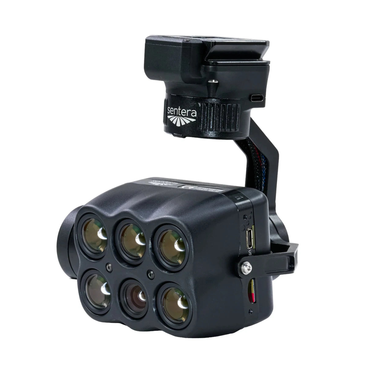
The Sentera 6X Multispectral Camera Payload for IF800 turns a single flight into a complete data-capture event, synchronizing five multispectral bands with 20 MP RGB imagery for operations that need science-grade vegetation data without stacking multiple passes.
Built on a stabilized Smart Dovetail gimbal designed specifically for the IF800 platform, this payload covers blue, green, red, red edge, and near-infrared bands alongside high-resolution visual imagery in one integrated system. Whether you're running a first multispectral mission or scaling a research program across multiple fields, a 512 GB internal SSD and 5 FPS capture rate keep storage and speed from slowing you down.
Key Features and Benefits
- Five-band multispectral: captures blue, green, red, red edge, and NIR data.
- High-res RGB imaging: 20 MP imager adds visual field context to results.
- One-flight efficiency: synchronized capture removes the need for multiple sensor passes.
- Radiometric precision: incident light sensor adjusts for shifting field conditions.
- Field-calibrated accuracy: included reflectance panel supports precise measurement standards accurately.
- Efficient coverage: 5 FPS capture rate supports faster flights over large areas.
- Onboard storage: 512 GB internal SSD supports full missions without interruption.
- Stable imaging platform: Smart Dovetail gimbal keeps data consistent in flight.
- Accurate alignment: time-of-capture geotagging supports clean post-flight data processing workflows.
- Procurement-ready compliance: NDAA and Blue UAS certification meets government standards.
Accuracy that holds up across a growing season matters more than raw resolution when the deliverable feeds a vegetation index or research dataset. This sensor pairs its multispectral imagers with an incident light sensor and calibrated reflectance panel, plus pulse-per-second synchronization and precise geotagging, correcting for changing light conditions as they happen mid-flight.
At 515 grams mounted on the Smart Dovetail gimbal, the added weight stays well within what the IF800 platform is built to carry without cutting into flight time. Open, standardized data formats mean this payload plugs directly into whatever agronomic or research analytics pipeline your operation already runs.
Data You Can Trust Across a Full Season
Data consistency across a growing season depends on more than a capable sensor; it depends on a system engineered to correct for real-world variability. Synchronized capture across all six channels keeps multispectral, RGB, and index outputs perfectly aligned without manual correction in post-processing, whether you're running one flight or coordinating survey dates across an entire season.
The calibrated reflectance panel and incident light sensor work together to hold radiometric values steady even as cloud cover or sun angle shifts mid-mission. Supported by open data formats, this payload integrates directly into the agronomic or research analytics pipeline your operation already depends on.
Compatibility and System Integration
- Smart Dovetail gimbal: integrated mount built specifically for the IF800 (included).
- Incident Light Sensor and GPS Module: calibration hardware for accurate capture (included).
- Calibrated Reflectance Panel: field reference tool supporting radiometric accuracy (included).
- External power supply and cabling: complete connection kit for operation (included).
- Inspired Flight IF800 aircraft: required host platform for this payload (sold separately).
- Multispectral processing software: broad industry support for 6X data formats (sold separately).
Applications and Use Cases
- Crop health monitoring: multispectral bands identify plant stress before visible symptoms.
- Yield forecasting: seasonal capture supports biomass and growth stage assessments accurately.
- Weed pressure mapping: spectral contrast separates crop canopy from weed growth.
- Stand count analysis: high-resolution imagery supports emergence and population counting.
- Environmental and land research: vegetation index data supports conservation planning efforts.
- Multi-field research programs: synchronized capture supports consistent cross-plot comparisons reliably.
The Sentera 6X exists to give agronomists and researchers radiometrically accurate vegetation data without the workflow overhead of multiple sensor passes or manual calibration. Synchronized capture, calibrated reflectance, and open data formats mean this payload fits directly into whatever analytics pipeline your operation already runs, at any scale.
Whether you're outfitting a single IF800 for your first multispectral season or expanding a research program across multiple aircraft, this payload delivers the same calibrated accuracy from day one. Dronefly stocks the Sentera 6X for operators who want proven data quality without piecing together components separately.
Shop the Sentera 6X Multispectral Camera Payload for IF800 now at Dronefly.


