

MicaSense RedEdge-P Blue Multispectral kit
MicaSense RedEdge-P Blue Multispectral kit

Couldn't load pickup availability

- Description
- Specifications
- In the Box
- FAQ
MicaSense RedEdge-P Blue Multispectral Kit: coastal multispectral intelligence with expandable band architecture
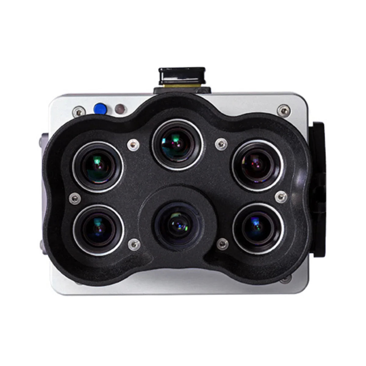
The MicaSense RedEdge-P Blue Multispectral Kit is purpose-built for enterprise users performing precision agriculture, environmental monitoring, and water-focused aerial surveys. As a standalone system, it captures five multispectral bands optimized for coastal and aquatic analysis using synchronized global-shutter sensors and radiometric calibration. Its ocean blue wavelength enables enhanced visibility in shallow water environments and improved vegetation stress detection.
Built on the modular RedEdge-P platform, the RedEdge-P Blue also supports expansion into dual and triple sensor configurations, allowing teams to increase spectral coverage while maintaining consistent data quality and operational workflows.
Coastal-optimized multispectral system and expansion features
- Standalone coastal blue multispectral sensor for water and vegetation analysis
- Ocean blue band enhances shallow water and aquatic environment monitoring
- Global shutter sensors eliminate motion distortion during survey flights
- Radiometric calibration supports repeatable quantitative data collection
- Modular architecture supports expansion into dual sensor configurations
- Dual systems allow selection of up to ten multispectral bands
- Expandable into RedEdge-P Triple configuration with fifteen bands
- Synchronized multi-sensor capture preserves temporal and spatial alignment
Reliable spatial resolution for analytical workflows
The RedEdge-P Blue captures multispectral imagery at 1456 × 1088 pixels per band, paired with a 2464 × 2056 pixel panchromatic sensor and a 5.1 MP RGB output aligned across all bands. At 120 m (≈400 ft) AGL, the system delivers a ground sample distance of 7.7 cm (3 in) per multispectral band and 3.98 cm (1.5 in) for the panchromatic band. With pan-sharpening applied during post-processing, spatial resolution can reach 2 cm (0.8 in) per pixel. Global shutter architecture ensures distortion-free imagery during motion-intensive missions.
Scalable spectral coverage from single to triple configurations
The RedEdge-P Blue Multispectral Kit is designed to scale with operational requirements. Used independently, it provides coastal-optimized multispectral data for water and vegetation analysis. When paired with a RedEdge-P or RedEdge-P Green sensor, the system forms a dual configuration supporting up to ten selectable bands from a fifteen-band ecosystem.
When combined with both RedEdge-P and RedEdge-P Green sensors, it becomes part of the RedEdge-P Triple configuration, enabling synchronized capture of all fifteen multispectral bands for advanced pigment analysis, stress detection, and research-grade spectral differentiation.
Platform compatibility and workflow integration
- Compatible with DJI SkyPort-equipped enterprise aircraft (Matrice 300/350)
- Supports single, dual, and triple sensor mounting configurations
- Includes DLS 2 downwelling light sensor with integrated GPS
- Calibrated reflectance panel supports radiometric correction
- Interfaces include Ethernet, serial, USB, and configurable GPIO
- CFexpress storage supports high-speed raw DNG capture
- Protective hard carrying case included for field deployment
Enterprise use cases and operational scenarios
- Precision agriculture analysis: crop vigor, chlorophyll efficiency, stress detection
- Water quality monitoring: algae blooms, sediment suspension, aquatic vegetation
- Coastal and near-shore mapping: tidal zones, wetlands, shoreline environments
- Environmental monitoring: ecosystem health and long-term change tracking
- Vegetation research: species differentiation and invasive plant identification
- Forestry assessment: canopy condition and vegetation classification
- Conservation programs: biodiversity monitoring and habitat restoration
- Academic research: high-band-count multispectral data acquisition
Engineered for mission reliability and system scalability
The RedEdge-P Blue Multispectral Kit is engineered for professional operations requiring dependable data, scalable architecture, and long-term consistency. Double radiometric calibration using a downwelling light sensor and reflectance panel supports reliable datasets across changing light conditions. Its modular design enables organizations to deploy a single coastal-focused sensor today and expand into dual or triple configurations as analytical demands grow, without altering established workflows or processing pipelines.
The MicaSense RedEdge-P Blue Multispectral Kit delivers coastal-optimized spectral intelligence with a clear path to higher band counts. From standalone surveys to fully synchronized fifteen-band systems, it supports confident, data-driven decision-making across land and water environments.
Order from Dronefly today — the West Coast’s trusted enterprise UAV source.

