


DJI Mavic 3 Multispectral
DJI Mavic 3 Multispectral

Couldn't load pickup availability


- Description
- Specifications
- In the Box
- FAQ
DJI Mavic 3 Multispectral: Integrated RGB and Multispectral Surveying Platform for Precision Agriculture
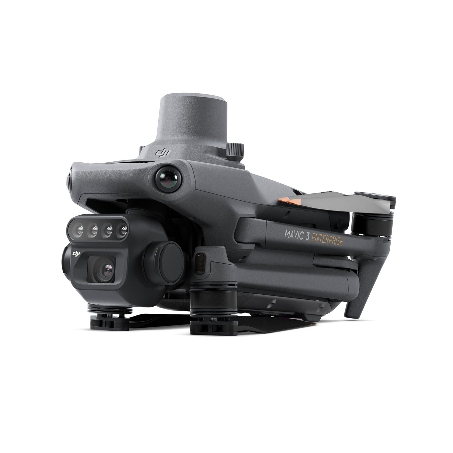
The DJI Mavic 3 Multispectral redefines what a sub-kilogram UAV can deliver for precision agriculture and environmental monitoring. At 951 grams with its RTK module pre-mounted, it integrates a 20MP 4/3 CMOS RGB camera with four 5MP multispectral cameras, scanning green, red, red edge, and near-infrared bands simultaneously, into a foldable airframe that transitions from carrying case to airborne in minutes.
For agronomists, survey teams, and natural resource managers who need field-grade multispectral data without the logistical overhead of larger platforms, the Mavic 3M delivers the imaging system, positioning accuracy, and flight endurance to support operations at scale.
Key Features and Benefits
- 20MP RGB camera: 4/3 CMOS with mechanical shutter eliminates motion blur at mapping speeds.
- Four 5MP multispectral cameras: simultaneous G, R, RE, and NIR capture in a single pass.
- RTK module: pre-mounted for centimeter-level accuracy with microsecond synchronization.
- Sunlight sensor: per-image irradiance recording for consistent NDVI across variable conditions.
- 43-minute endurance: covers up to 200 hectares per flight under optimal conditions.
- O3 Enterprise transmission: 15 km range with 1080p/30fps live view to RC Pro controller.
- APAS 5.0: omnidirectional obstacle avoidance active in Normal and Tripod flight modes.
- Terrain follow: real-time vision-based or DSM-based altitude adjustment over sloped terrain.
- 951 g foldable airframe: compact enough for a standard field bag, deployable in minutes.
- Multi-constellation GNSS: GPS, Galileo, BeiDou, and GLONASS for reliable autonomous navigation.

Where conventional mapping platforms require separate RGB and multispectral flights, the Mavic 3M captures both datasets in a single pass. The pre-mounted RTK module synchronizes with the flight controller and all five cameras at the microsecond level, tagging each image with centimeter-accurate geospatial coordinates, no ground control points required.
A built-in sunlight sensor embeds solar irradiance data directly in every image file, enabling light compensation during reconstruction and producing NDVI results that remain consistent across different times, weather conditions, and flight dates. With 43 minutes of flight endurance and coverage of up to 200 hectares per mission, the Mavic 3M is a platform built for operators who need to move fast and trust their data.
Dual-Sensor Data From a Single Deployable Platform
For fleet managers and solutions partners deploying multispectral surveying programs, the Mavic 3M's value is in what it consolidates. A single aircraft, a single flight, and a single dataset covers both RGB mapping and four-band spectral analysis — eliminating the scheduling, coordination, and data reconciliation that comes with running separate platforms for each task.
The RC Pro Enterprise controller's 5.5-inch, 1,000 nit display supports full mission management in direct sunlight, and the DJI Pilot 2 app's integrated flight task library handles waypoint, mapping, oblique, and linear missions without external planning software.
For organizations building out multi-site precision agriculture programs or environmental monitoring networks, the Mavic 3M's open Cloud API and MSDK5 support direct integration with third-party platforms and proprietary operational workflows.
Compatibility and System Integration
- DJI RC Pro Enterprise: included controller with 5.5 in display, 3-hour battery, and GNSS.
- D-RTK 2 High Precision GNSS Mobile Station: expands RTK range for large-scale survey operations.
- Network RTK: NTRIP server integration via RC Pro Enterprise Wi-Fi for continuous correction.
- DJI Terra: compatible for 2D/3D mapping, Smart Oblique reconstruction, and DSM generation.
- DJI SmartFarm Platform: compatible for NDVI/GNDVI/NDRE maps, prescription generation, and field scouting.
- DJI Agras series: Mavic 3M multispectral data feeds directly into variable-rate spray missions.
- DJI Cloud API and MSDK5: open ecosystem for third-party platform integration and custom app development.
Applications and Use Cases
- Precision crop monitoring: four-band spectral data identifies stress, disease, and yield variability.
- High-precision aerial mapping: centimeter RTK accuracy supports surveys without ground control points.
- Orchard and sloped terrain surveying: terrain-follow capability maintains consistent GSD across elevation changes.
- Prescription spraying integration: NDVI-based maps guide DJI Agras variable-rate application missions.
- Environmental and natural resource surveys: NIR and red edge bands support forest and vegetation monitoring.
- Water enrichment and aquatic monitoring: multispectral data detects surface water and aquatic vegetation conditions.
- Multi-site fleet deployment: compact form factor supports parallel operations across multiple survey areas.

The Mavic 3M addresses a persistent challenge in precision agriculture deployment: how to collect both RGB mapping data and multispectral vegetation index data efficiently, accurately, and at a cost that scales across an operation. At 951 grams with 43 minutes of endurance, centimeter RTK positioning, and a fully open software ecosystem, it delivers enterprise-grade dual-sensor capability in a platform that any qualified operator can carry into the field and fly the same day.
Dronefly has built its reputation on matching the right UAV platform to the right operational requirement, and the DJI Mavic 3 Multispectral is the platform that precision agriculture and environmental monitoring programs keep asking for.
When you source the Mavic 3M through Dronefly, you gain access to configuration guidance, workflow consultation, and the fleet deployment expertise to integrate multispectral data collection into your existing operations from day one.
Reach out to Dronefly today to discuss how the Mavic 3M fits your program.

